0250L-SUNDAY OUTLOOK FROM GARFIELD COUNTY EMERGENCY MANAGEMENT- 11/16/25
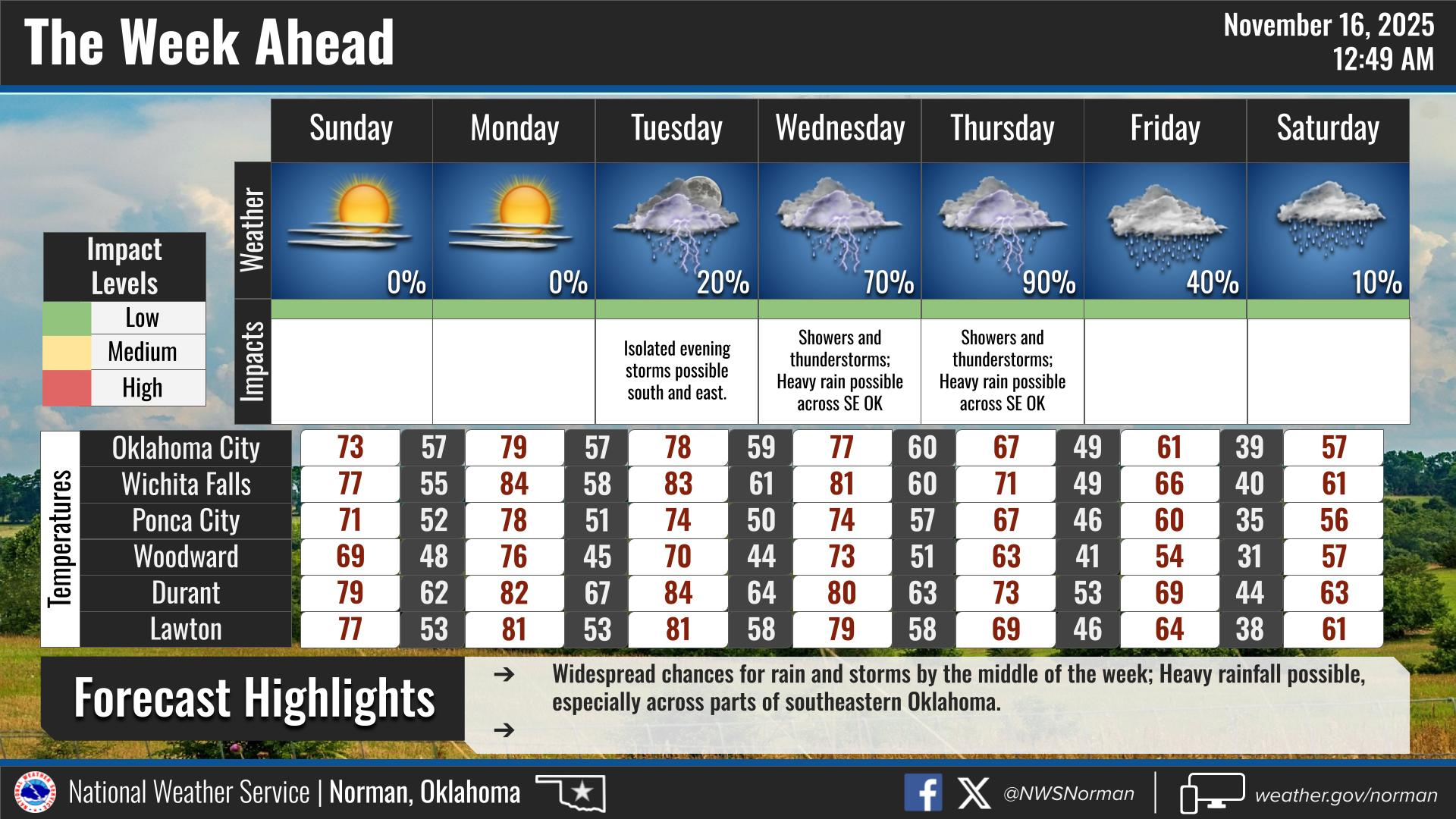
Today should be a little cooler than yesterday by roughly 10 degrees or so. Highs were around 77 yesterday and we’ll see highs around 70 today due to that front that came through on Saturday. We do expect several fronts this week but the main event looks to be a CHANCE for rain around mid-week. There are some variables in locations but we’ll see how this tracks and we’ll deal with it.
Winds will become a factor over the next few days so controlled burning may become an issue. The fire danger is increasing so be extremely careful while utilizing anything related to fire.
Overall, we’ll be ok, so here is your forecast from the NWS/NORMAN:
Sunday- Mostly sunny. Highs around 70. East winds 5 to 10 mph with gusts up to 20 mph.
Sunday Night- Mostly clear in the evening, then becoming partly cloudy. Lows in the lower 50s. Southeast winds 5 to 10 mph.
GARFIELD COUNTY EM is our notification and preparedness app. If you don’t have it, you’re NOT prepared! REMEMBER that each day’s post appears under the GCEM Blog icon on the app.
HAVE A GOOD DAY!