0300L-THURSDAY OUTLOOK FROM GARFIELD COUNTY EMERGENCY MANAGEMENT- 11/20/25
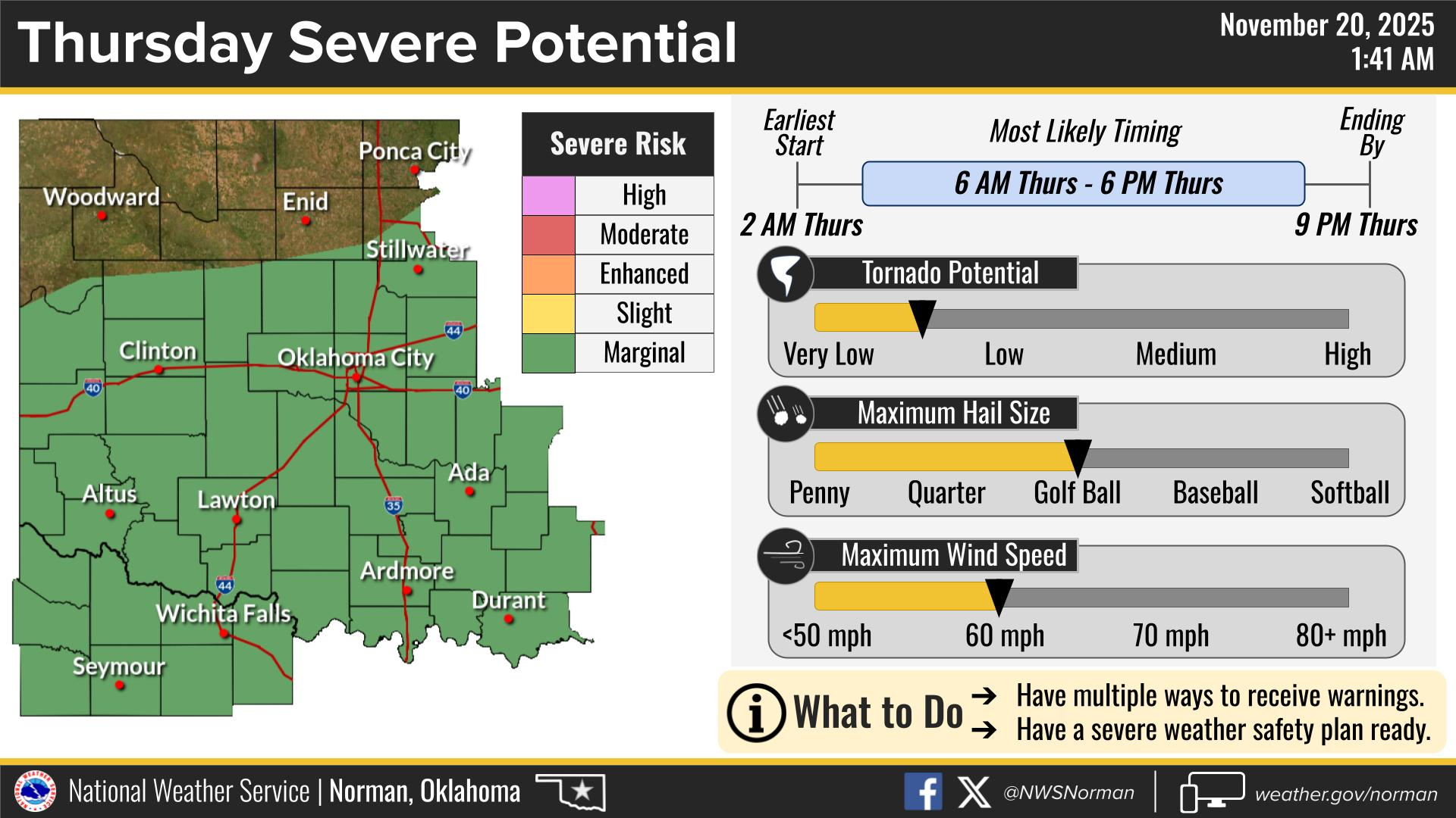
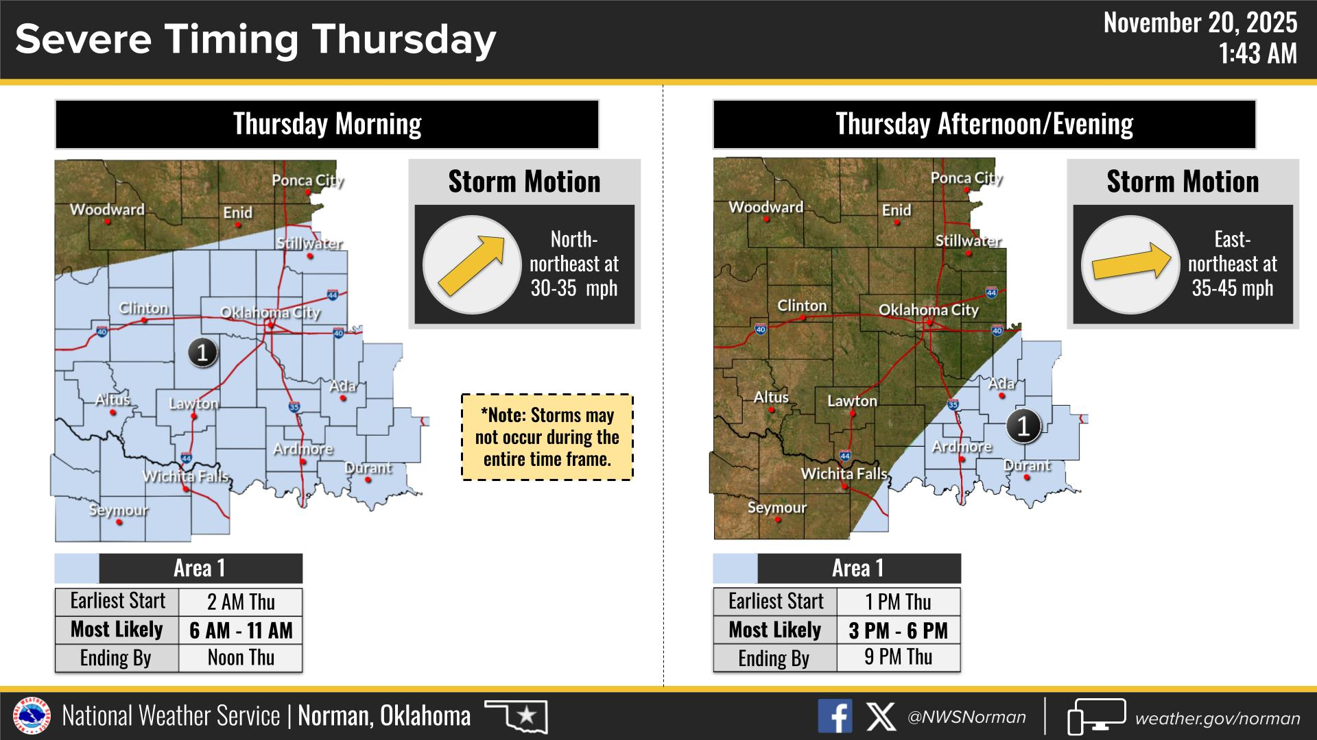
MARGINAL RISK for severe weather this morning and later this afternoon. There are a few scenarios that could occur but the main issue will be heavy rainfall and hail if storms do affect our area. There is always that “T” threat but it looks like that higher threat would be across Central Texas into SE Okla, and Western Arkansas, per guidance. Just be prepared for the possibility of some thunderstorm activity. We’ll keep an eye out and advise if needed.
Overall, we’ll be ok, so here is your forecast from the NWS/NORMAN:
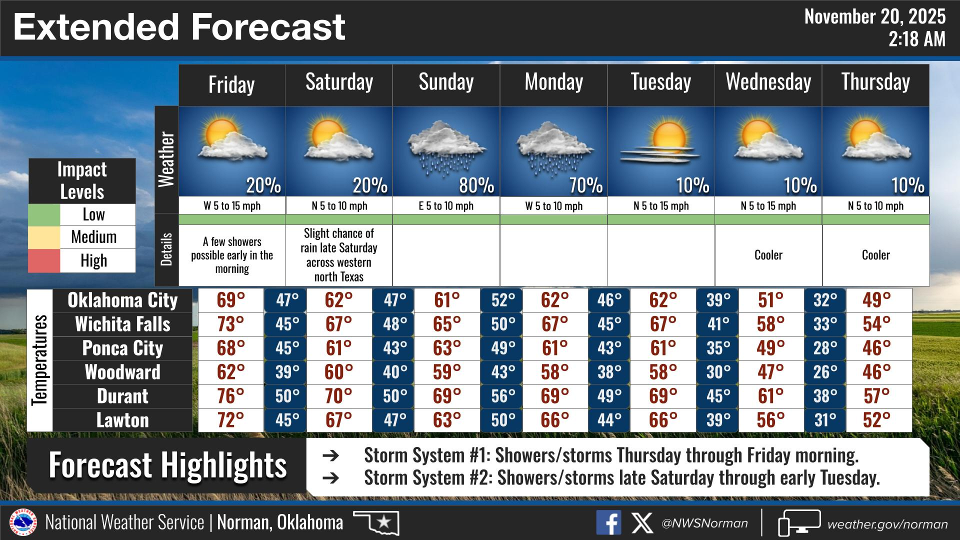
Thursday- Cloudy with a chance of thunderstorms. A chance of showers in the morning, then showers in the afternoon. Highs in the upper 60s. Southeast winds 5 to 10 mph. Chance of rain 90 percent.
Thursday Night- Mostly cloudy. Showers with a slight chance of thunderstorms in the evening, then a slight chance of showers after midnight. Lows in the lower 50s. South winds 5 to 10 mph. Chance of rain 80 percent.
GARFIELD COUNTY EM is our notification and preparedness app. If you don’t have it, you’re NOT prepared! REMEMBER that each day’s post appears under the GCEM Blog icon on the app.
HAVE A GOOD DAY!