0300L-FRIDAY OUTLOOK FROM GARFIELD COUNTY EMERGENCY MANAGEMENT- 11/28/25
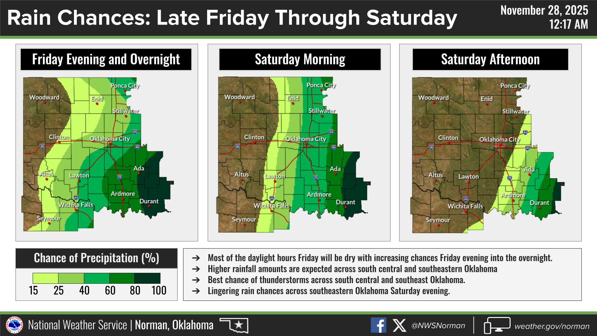
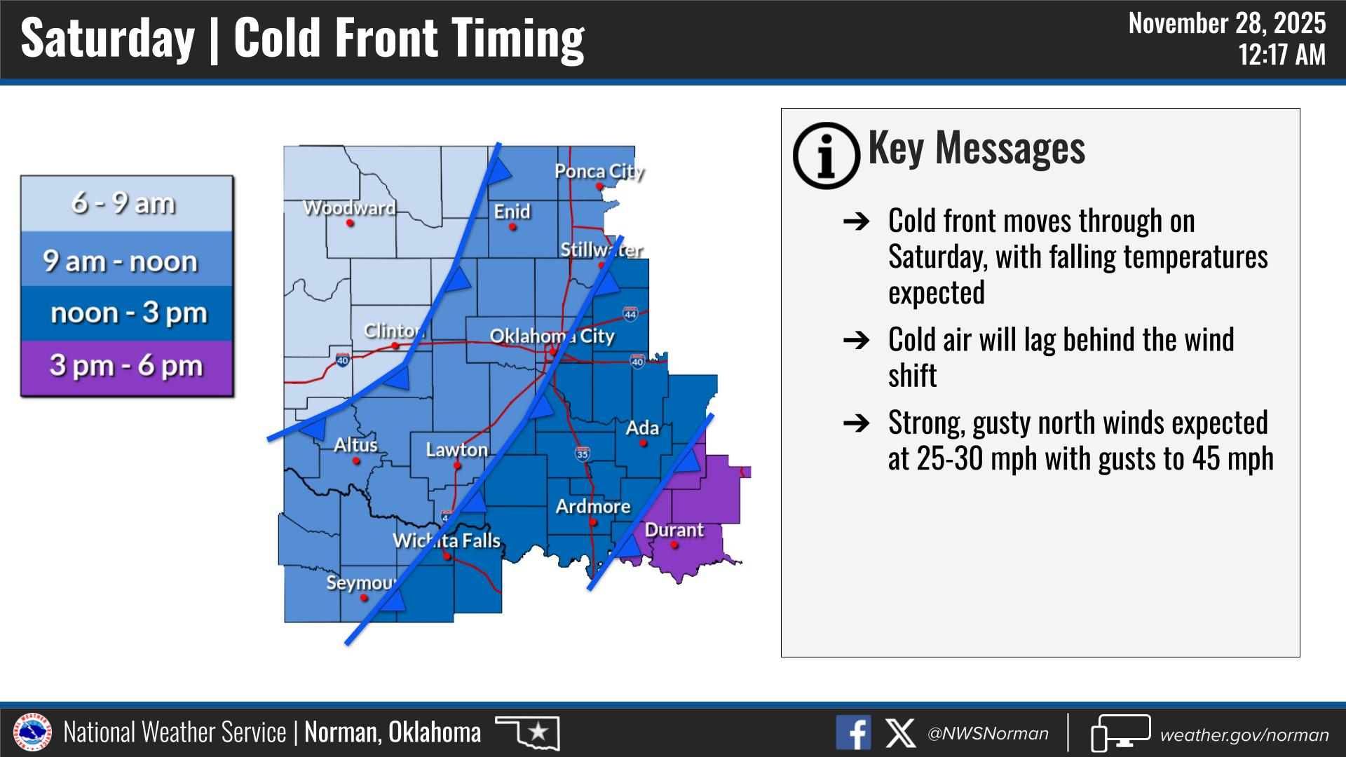
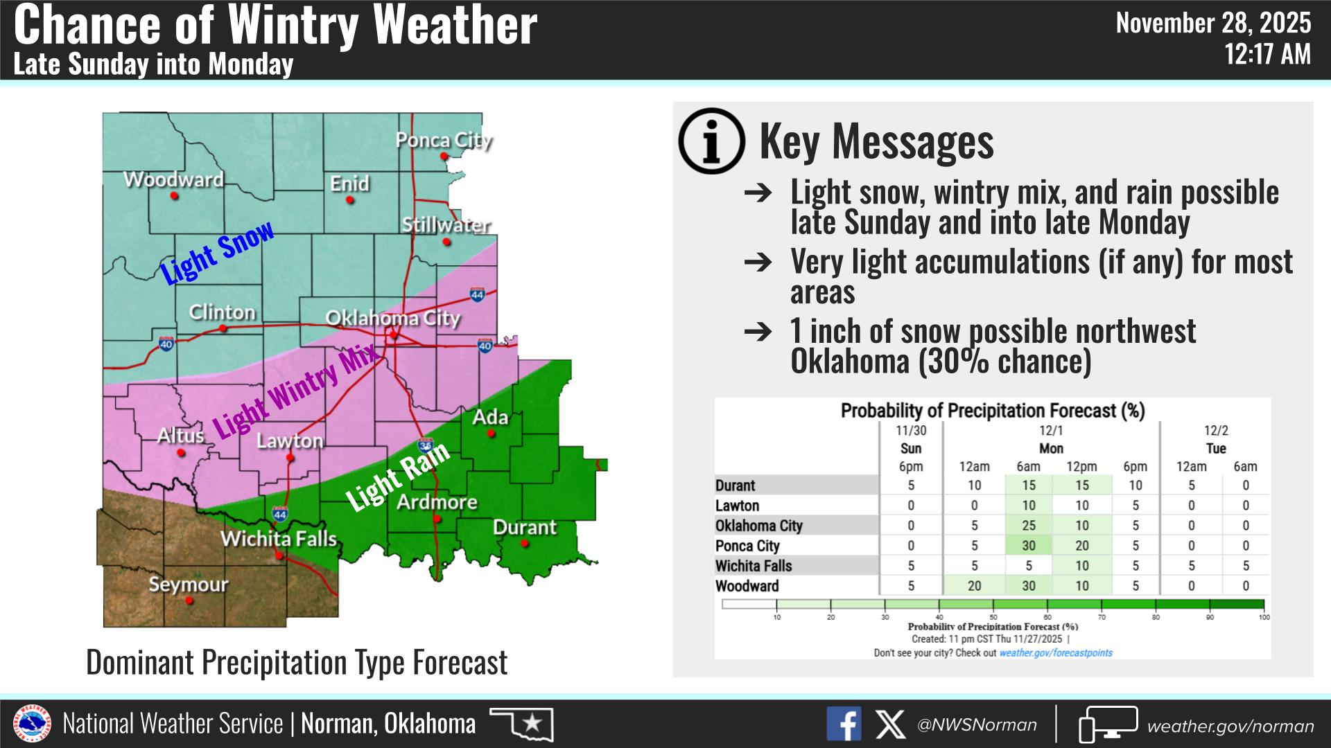
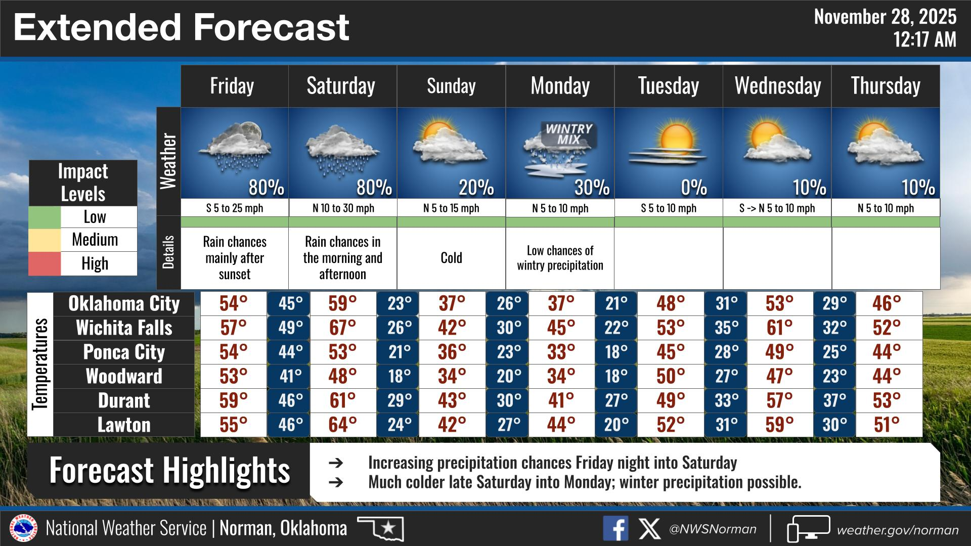
Warm, except for the winds in store for today. Very slight chance for a shower later this evening but nothing major. Saturday morning, a cold front will push in bringing Canadian air and it will be downhill temperature-wise until roughly Tuesday into Wednesday. Sunday and Monday highs will be in the low 30s with a chance for light snow early Monday morning through the day. NOW is the time to make sure you are prepared for an extended time for much colder weather.
Other than that, the only issue I see for today is the shopping threat. Use extreme caution at the end of each isle. Hold on to items tightly and keep your head on a swivel inside whatever building you’re in and out in the parking lots.
Overall, we’ll be ok so here’s your forecast from the NWS/NORMAN:
Friday- Partly sunny in the morning, then becoming cloudy. Highs in the mid-50s. South winds 15 to 20 mph with higher gusts.
Friday Night- Cloudy with a 20 percent chance of showers. Lows in the lower 40s. South winds around 20 mph with gusts up to 35 mph.
GARFIELD COUNTY EM is our notification and preparedness app. If you don’t have it, you’re NOT prepared! REMEMBER that each day’s post appears under the GCEM Blog icon on the app.
HAVE A GOOD DAY!