0255L-TUESDAY OUTLOOK FROM GARFIELD COUNTY EMERGENCY MANAGEMENT- 12/2/25
Today should be a bit warmer than yesterday but we have a weak front that will move through later tonight. Then Wednesday, another front will bring a chance for a winter mix, most likely south of us, depending on the storm track. Chances for any precip here are low at least for now.
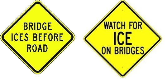
The above said, we warn about bridges and overpasses for a reason, even if we only receive a trace of precipitation. BRIDGES WILL FREEZE BEFORE A ROADWAY WILL. There is nothing around a bridge but air. Bridges are steel and concrete. Because there is no ground under the bridge, it gets colder, quicker than the roadway with the ground insulating the roadway. Therefore, ice will form faster on bridges. OKC AND TULSA had many accidents because of this reason yesterday. Word of caution, if we are near or below freezing and we have any moisture in the atmosphere, slow down when approaching bridges because slowing down on them is nearly impossible when a thin sheet of ice is on the bridge.
Overall, we’ll be ok so here’s your forecast from the NWS/NORMAN:
Tuesday- Sunny. Not as cool with highs in the lower 50s. South winds 10 to 15 mph.
Tuesday Night-Mostly clear. Cold with lows in the mid-20s. Southeast winds 5 to 10 mph.
GARFIELD COUNTY EM is our notification and preparedness app. If you don’t have it, you’re NOT prepared! REMEMBER that each day’s post appears under the GCEM Blog icon on the app.
HAVE A GOOD DAY!