0325L-WEDNESDAY OUTLOOK FROM GARFIELD COUNTY EMERGENCY MANAGEMENT- 12/3/25
IMPORTANT MESSAGE- The railroad has been replacing railroad ties on the line that goes northwest of Enid. Several crossings that were smooth are now dangerously rough. At Carrier, on 132, SLOW DOWN or you could lose control of your vehicle. The speed limit is 65 mph in the Carrier area. Seriously though, slow down. Several folks have called to complain. I will be checking other crossings and will advise on how rough other ones might be. I haven’t been able to contact anyone with the railroad yet but will today.
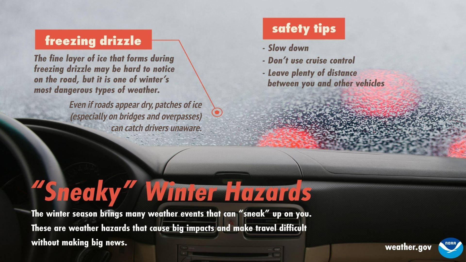
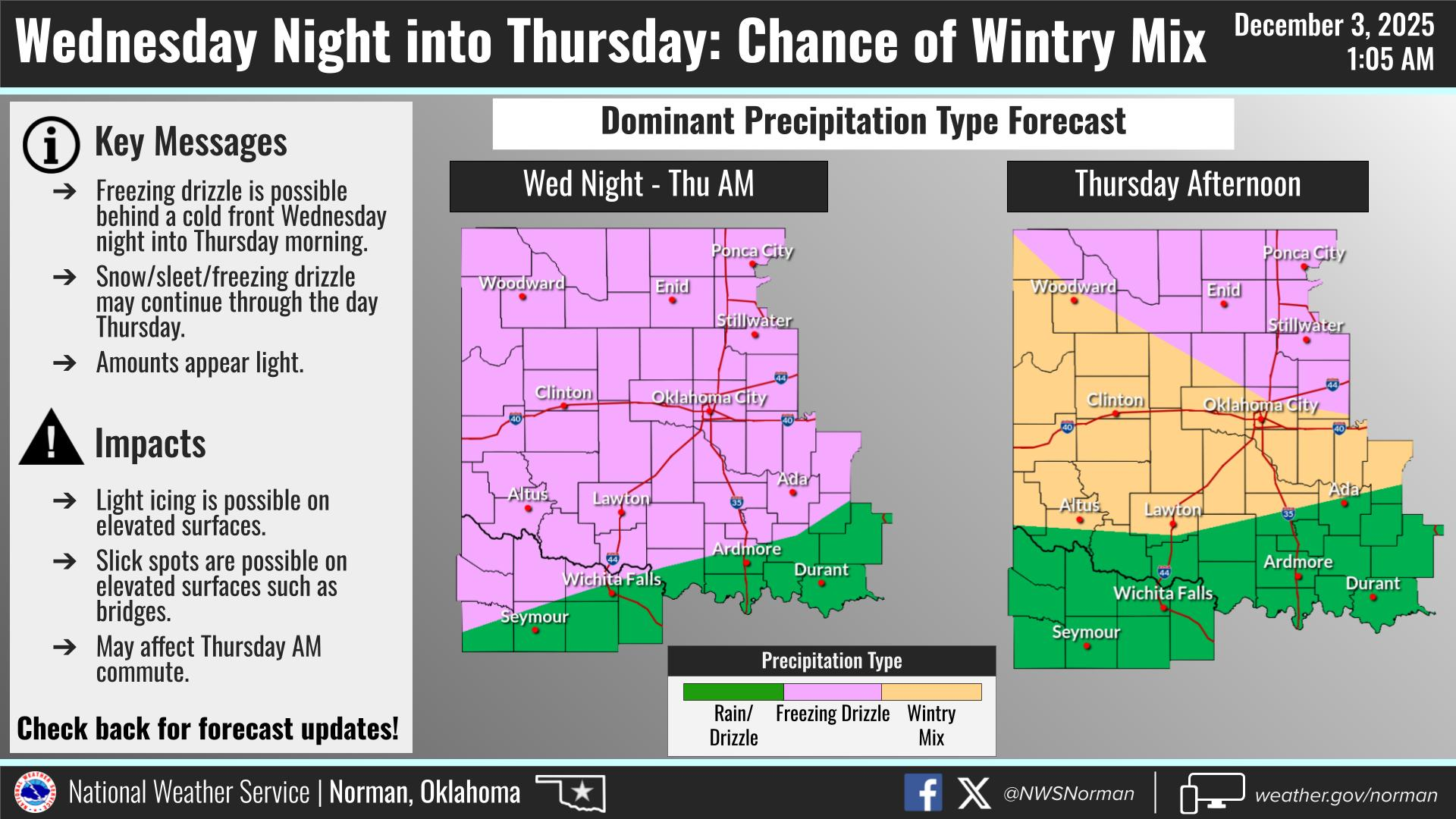
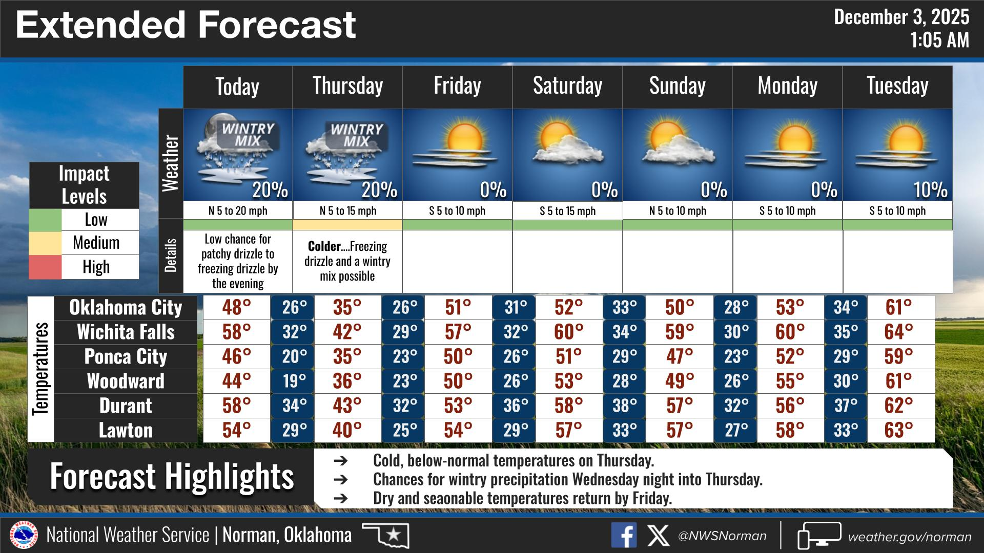
Another cold front will move through today bringing temps back on the downhill slide. Not expecting very much precip with this. Cold temperatures will lag behind like the last one did but colder air is coming. There is a chance for drizzle and then freezing drizzle as temps drop overnight. If we do see the drizzle, especially if we drop below 32, then use EXTREME CAUTION WHILE DRIVING and slow down BEFORE driving over bridges and overpasses. Just remember the nightmare the bigger cities had with folks thinking nothing was very slick. It doesn’t take much to start sliding around after that drizzle turns to ice. Wind chill temps will drop into the teens and possibly the single digits area tomorrow morning so bundle up the kids when they head to school.
Overall, we’ll be ok so here’s your forecast from the NWS/NORMAN:
Wednesday- Mostly sunny. A slight chance of very light drizzle in the afternoon. Highs in the mid-40s. East winds 5 to 10 mph, becoming north 10 to 15 mph with gusts up to 25 mph in the afternoon.
Wednesday Night-A slight chance of very light drizzle in the evening. Mostly cloudy with a slight chance of freezing drizzle. Cold with lows around 19. North winds 10 to 15 mph with gusts up to 25 mph.
GARFIELD COUNTY EM is our notification and preparedness app. If you don’t have it, you’re NOT prepared! REMEMBER that each day’s post appears under the GCEM Blog icon on the app.
HAVE A GOOD DAY!