0320L-THURSDAY OUTLOOK FROM GARFIELD COUNTY EMERGENCY MANAGEMENT- 12/4/25
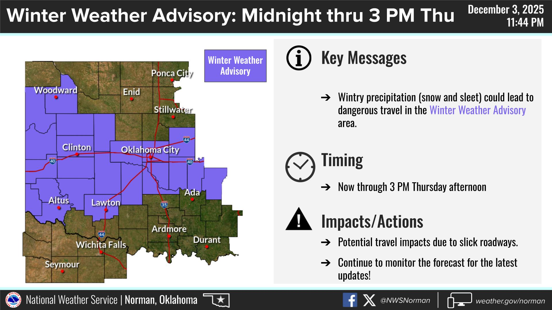
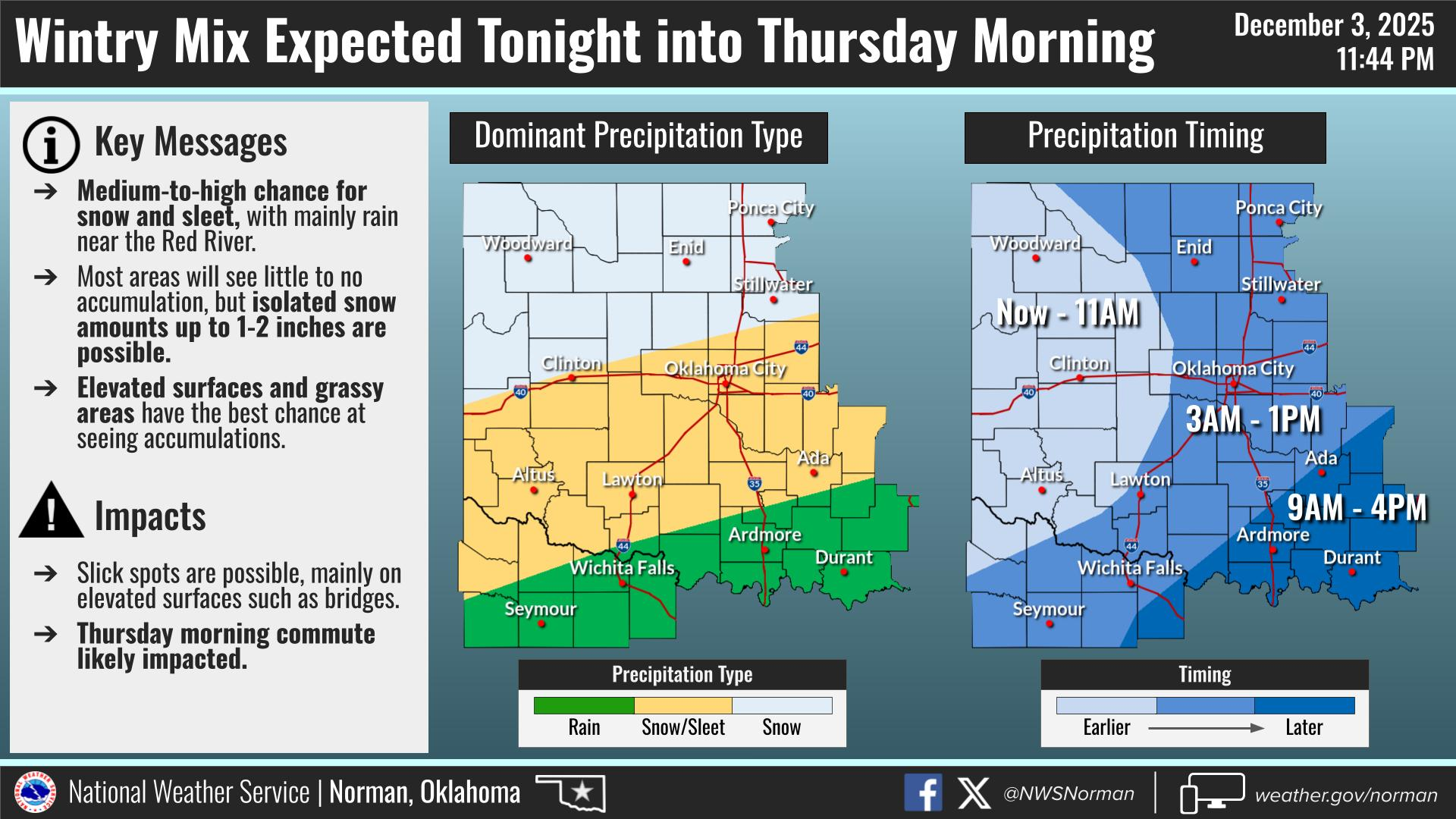
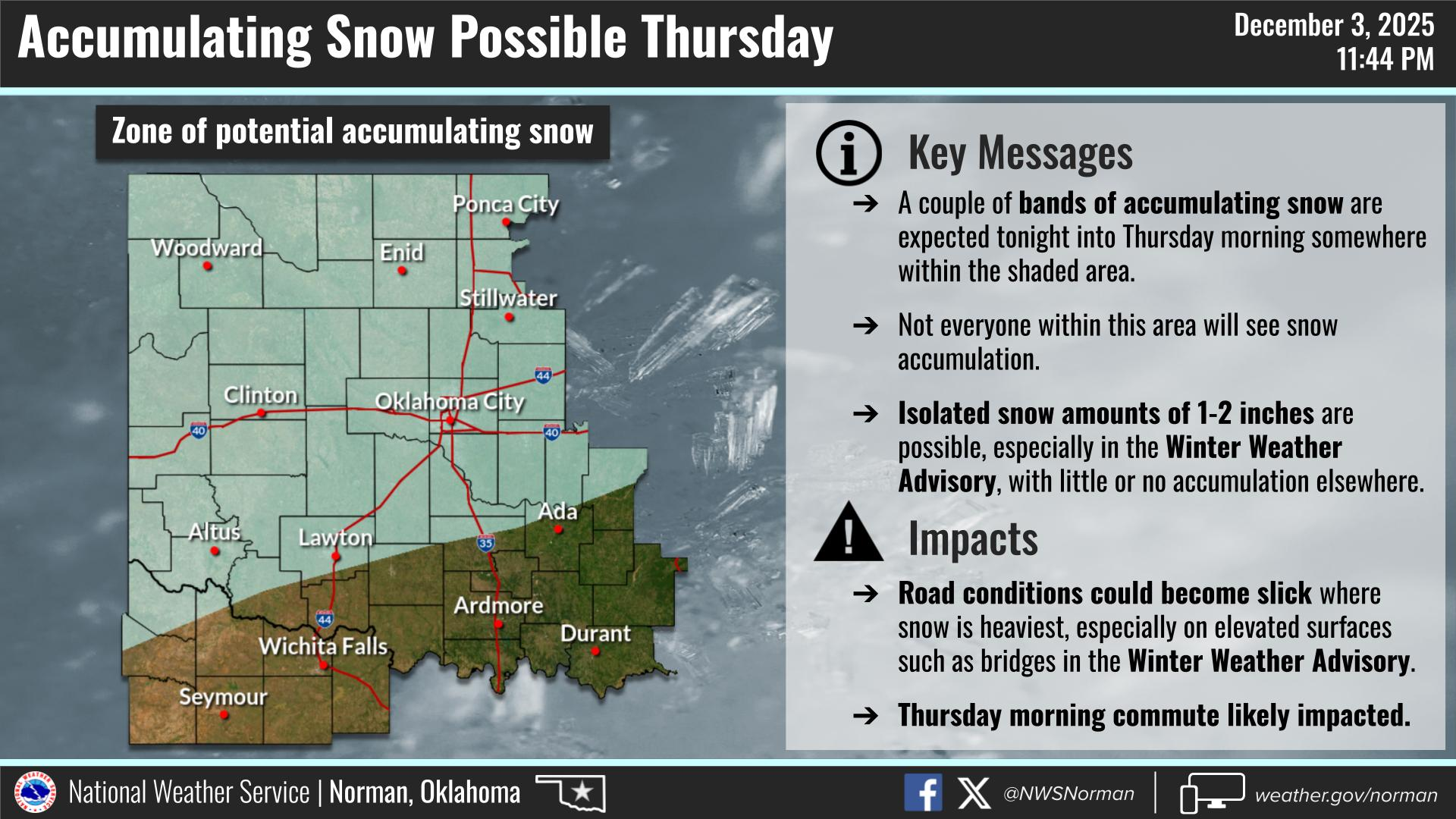
Cold and windy this morning with a slight chance for some snow. Accumulations here should be light, if at all. The main issue will be in the event we do see some freezing drizzle, sleet, or even snow and the bridges look wet, slow down as they may be slippery. Read the graphics attached carefully.
If you plan on traveling south today, use caution as that area is in a better precipitation zone. We’ll see what happens.
Pertaining to the railroad crossing at Carrier, it isn’t smooth like it was before the work, but it’s the “angle” of the road on the approach on either side that may cause a problem. Just slow down some and you should be ok.
Overall, we’ll be ok so here’s your forecast from the NWS/NORMAN:
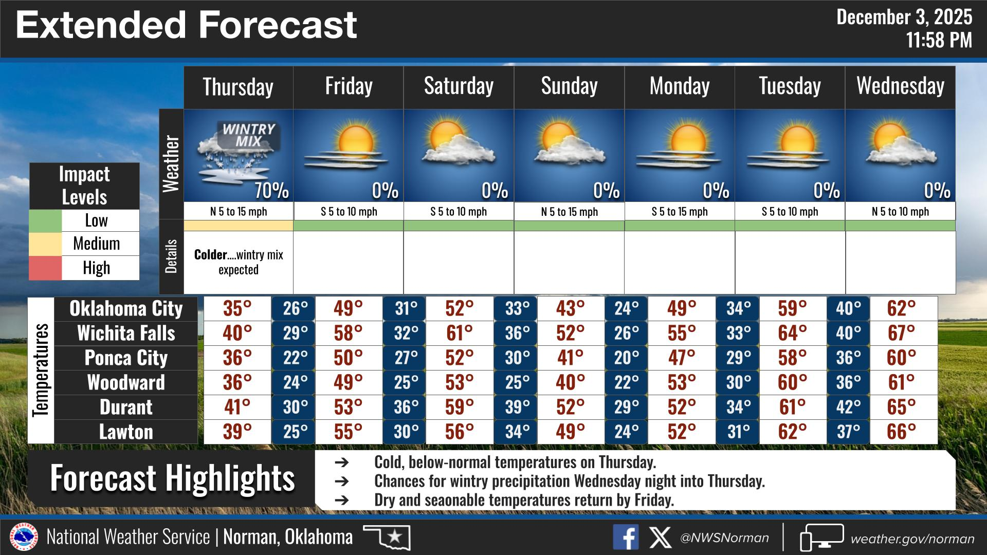
Thursday-Mostly cloudy in the morning, then becoming partly sunny. A 20 percent chance of snow showers. Highs in the mid-30s. Northeast winds 5 to 10 mph.
Thursday Night- Mostly clear. Cold with lows in the lower 20s. South winds around 5 mph.
GARFIELD COUNTY EM is our notification and preparedness app. If you don’t have it, you’re NOT prepared! REMEMBER that each day’s post appears under the GCEM Blog icon on the app.
HAVE A GOOD DAY!