0250L-SATURDAY OUTLOOK FROM GARFIELD COUNTY EMERGENCY MANAGEMENT- 12/6/25
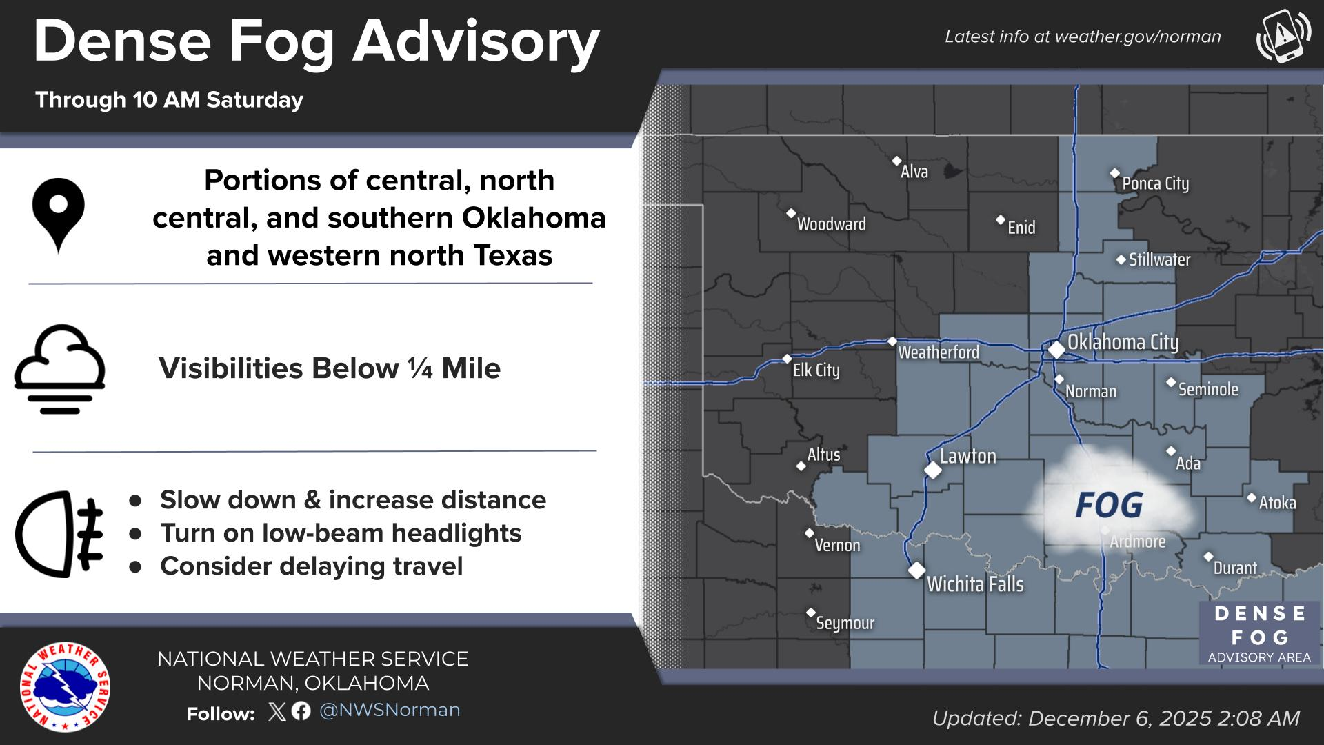
There is a DENSE FOG ADVISORY in effect East of a line from roughly Altus to Ponca City. We could see some fog around here too, but as stated yesterday, SLOW DOWN and use EXTREME CAUTION on bridges and overpasses. Remember that bridges and overpasses will freeze around 34 degrees and with mist/fog in the area they will be slick. If traveling east or south, watch out for dense fog and deer. Those critters will get you when you least expect it. Weather-wise, close to normal temps today before a cold front pushes in overnight tonight.
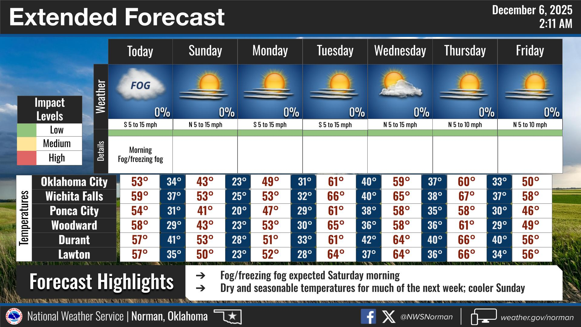
Overall, we’ll be ok so here’s your forecast from the NWS/NORMAN:
Saturday- Patchy freezing fog in the morning. Sunny. Highs in the mid-50s. South winds 10 to 15 mph.
Saturday Night- Partly cloudy in the evening, then clearing. Cold with lows in the lower 30s. Southwest winds 5 to 10 mph, becoming northwest 10 to 15 mph after midnight.
GARFIELD COUNTY EM is our notification and preparedness app. If you don’t have it, you’re NOT prepared! REMEMBER that each day’s post appears under the GCEM Blog icon on the app.
HAVE A GOOD DAY!