TUESDAY WEATHER OUTLOOK FROM GARFIELD COUNTY EMERGENCY MANAGEMENT – 01/06/2026
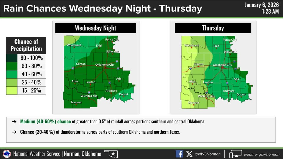
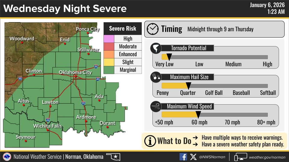
Good morning, Garfield County! We will continue with mild temperatures again today. Temperatures will remain 15-20 degrees above average. Enjoy another warm day and stay mindful of the dry conditions as we monitor fire safety and look ahead to rain chances later this week. Rain chances look to increase for Wednesday night into Thursday Morning. We are in a marginal risk for severe weather Wednesday night, with Hail and wind being the main threats. We will advise as needed.
Here is your detailed forecast from the NWS/Norman:
Today
Sunny. Highs in the mid-60s. Northwest winds 5 to 10 mph.
Tonight
Mostly clear in the evening, then becoming partly cloudy. Lows in the upper 30s. West winds around 5 mph, becoming south around 5 mph after midnight.
Safety Tips
- Fire Safety: While winds are slightly lower today, dry conditions persist. Please continue to avoid any activities that could produce sparks and ensure all trailer chains are secured to prevent dragging.
- Look Ahead: We are monitoring a weather system for mid-week that could bring our first real rain chances of the year. Stay tuned for updates on potential timing.
- Stay Informed: Remember to download our Garfield County EM app! The app is a great way to stay informed and prepared for changing conditions.
Stay safe and have a great Tuesday!
Jacob Price GCEM-1