FRIDAY WEATHER OUTLOOK FROM GARFIELD COUNTY EMERGENCY MANAGEMENT – 01/16/2026
Good morning, Garfield County!
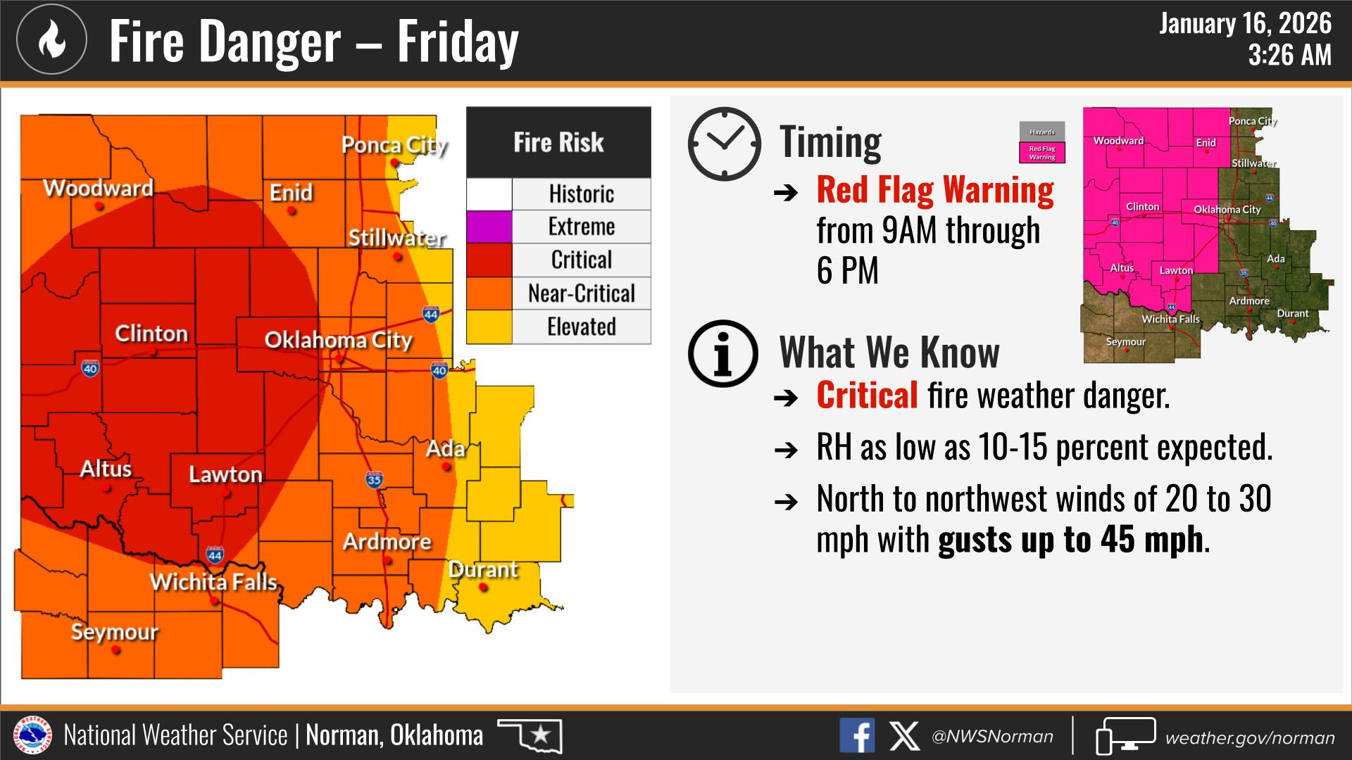
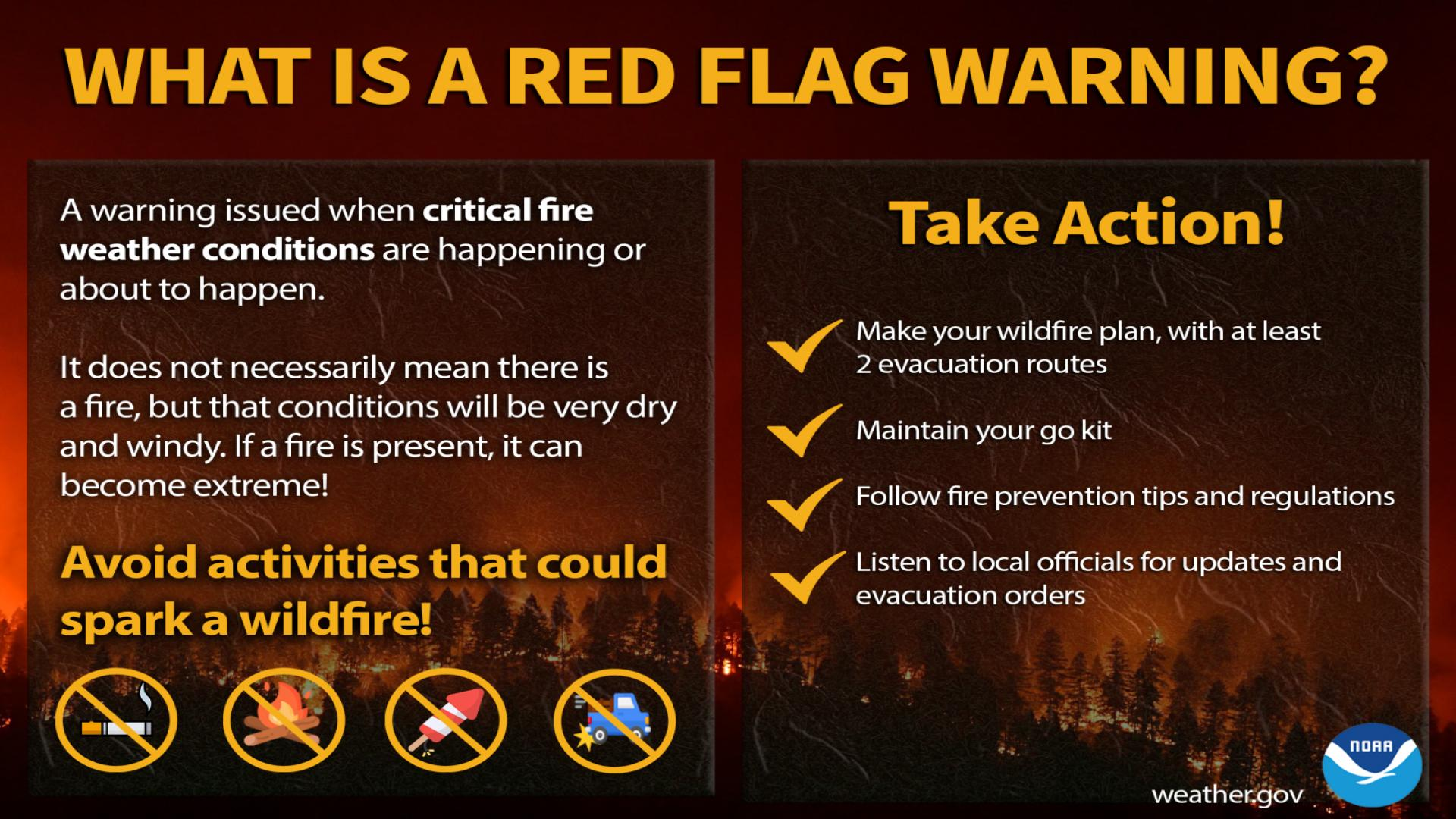
RED FLAG WARNING IN EFFECT FROM 9:00AM THROUGH 6:00PM.
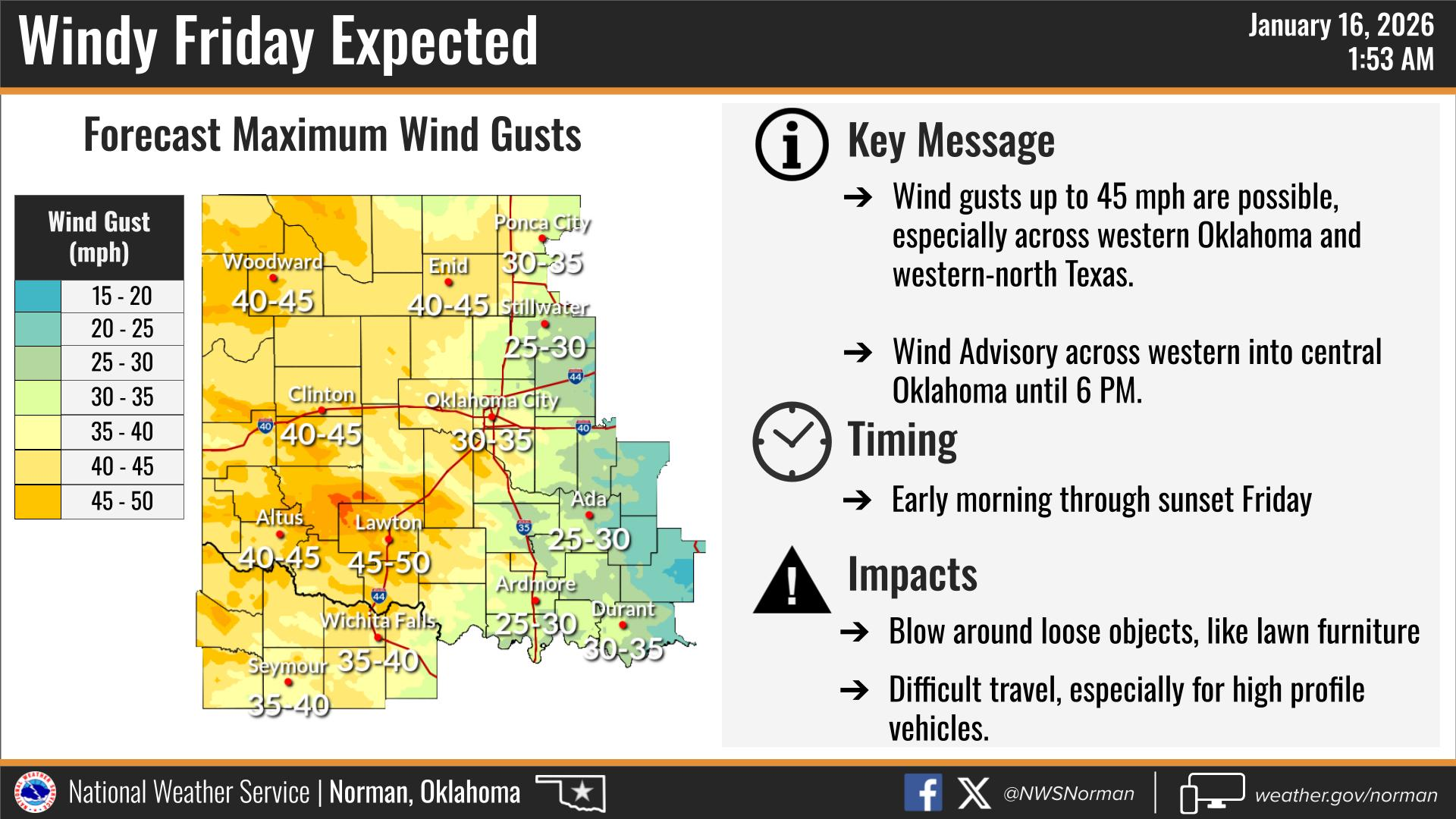
WIND ADVISORY IN EFFECT UNTIL 6:00PM.
A strong cold front will shift winds out of the NNW this morning at 20-30 mph with gusts up to 45mph. This will bring near critical to critical fire danger across the area. With the combination of strong winds, dry vegetation, and low humidity. Any fire that takes off today has the potential to move very quickly. I advise against any control burning, and activities that involve sparks or open flames. If you see smoke or fire, please call 911, so that a proper response can be dispatched.
Here is your forecast from the NWS/Norman:
Today – Sunny, windy with highs in the upper 40s. Northwest winds 20 to 30 mph with gusts up to 45 mph.
Tonight – Mostly clear. Cold with lows in the lower 20s. Northwest winds 15 to 20 mph.
Safety Tips
- Fire Safety: A Red Flag Warning is in effect from 9 AM to 6 PM today. Strong north winds and very dry air will result in critical fire danger. Please avoid any outdoor activities that could spark a fire.
- Wind Advisory: A Wind Advisory is also in effect until 6 PM. Secure any loose outdoor items and use extra caution if driving high-profile vehicles.
- Stay Informed: Download the Garfield County EM app to get the latest updates directly to your phone.
Have a safe day!
Jacob Price GCEM-1