WEATHER OUTLOOK FROM GARFIELD COUNTY EMERGENCY MANAGEMENT – 2/13/2026
Good morning, Garfield County!
I wanted to share a quick weather update for today and tomorrow based on the latest from the National Weather Service Norman office.
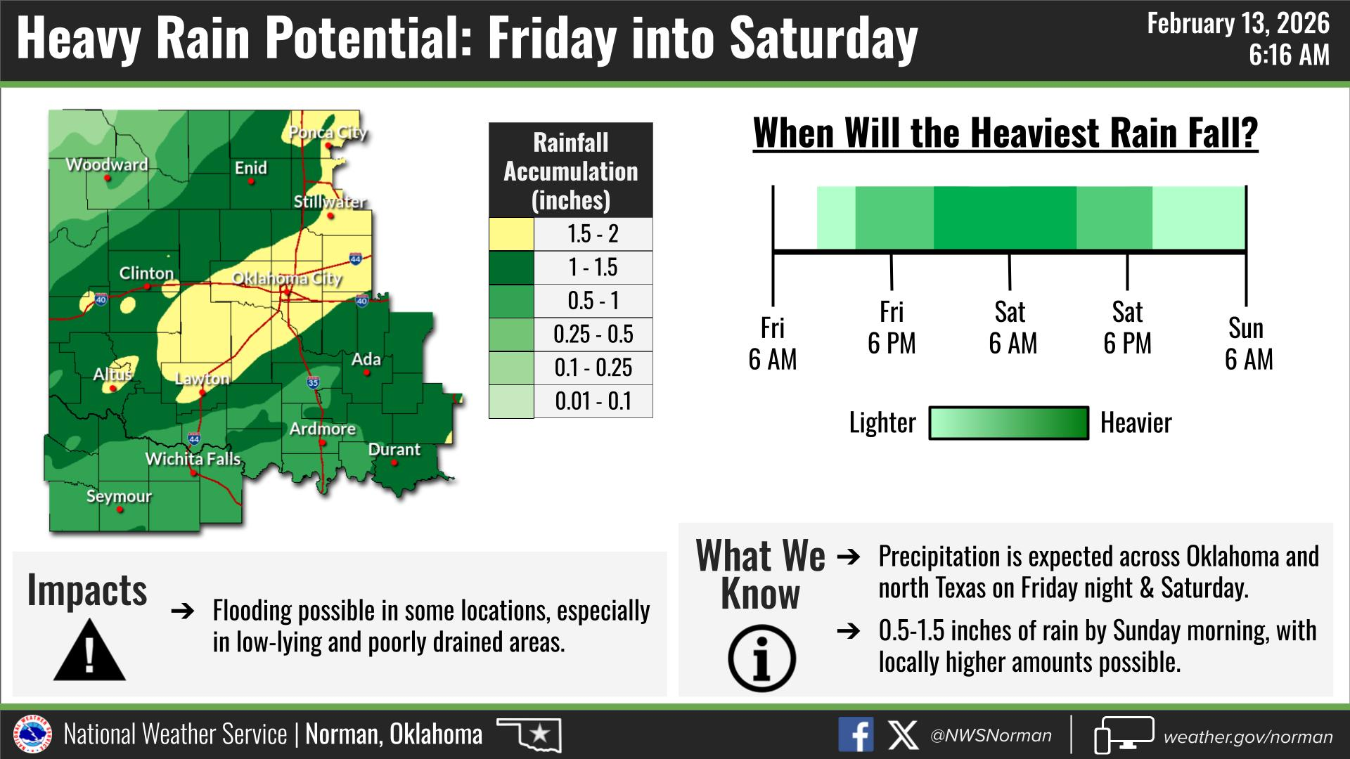
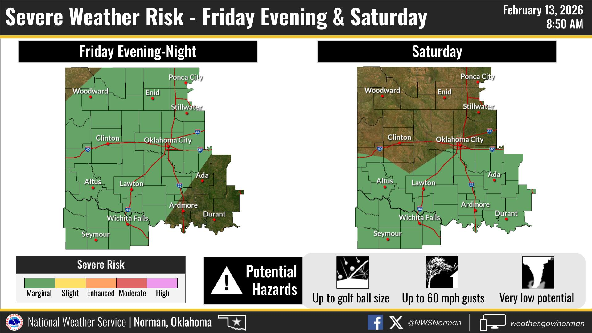
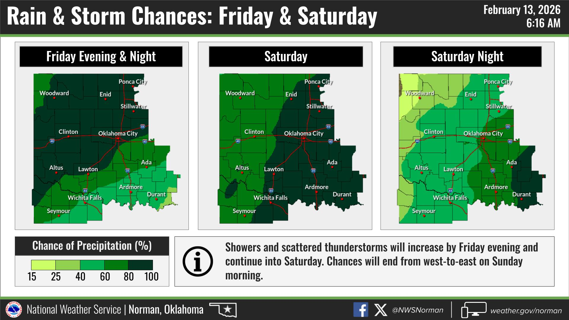
For today, storms are expected to develop later this afternoon into the evening. Not everyone will see severe weather, but there is a low-end (marginal) risk for a few strong storms. If anything turns severe, the main concerns would be hail and some strong wind gusts. Tornado potential is not Zero but very low. We could potentially see rain totals of up to 1.5” by the time Sunday comes around. Flooding is possible in some locations. Always remember “Turn Around Don’t Drown”! This doesn’t look like a big outbreak or anything major right now, but it’s always good to stay weather-aware this time of year. I’ll be keeping an eye on it and will post updates if anything changes.
HERE IS YOUR FORECAST FROM THE NWS/NORMAN:
TODAY – Partly sunny. A chance of showers and thunderstorms this afternoon. Highs around 70. East winds 5 to 10 mph. Chance of rain 40 percent.
TONIGHT – Showers with a chance of thunderstorms. Lows in the lower 50s. East winds 5 to 10 mph, becoming southeast after midnight. Chance of rain near 100 percent.
Don’t forget tomorrow is Valentines Day!
Have a great Friday!
Jacob Price GCEM-1