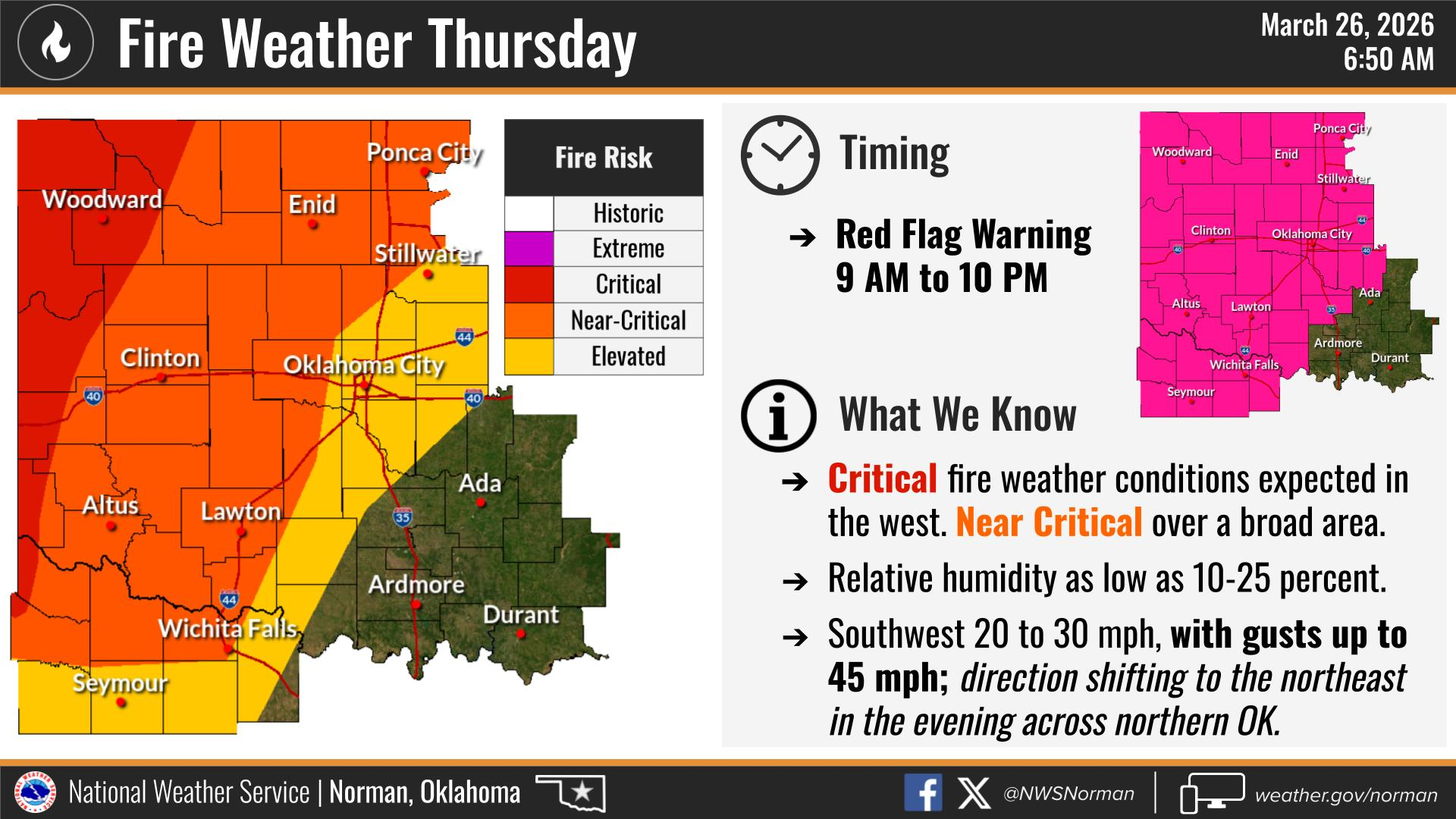
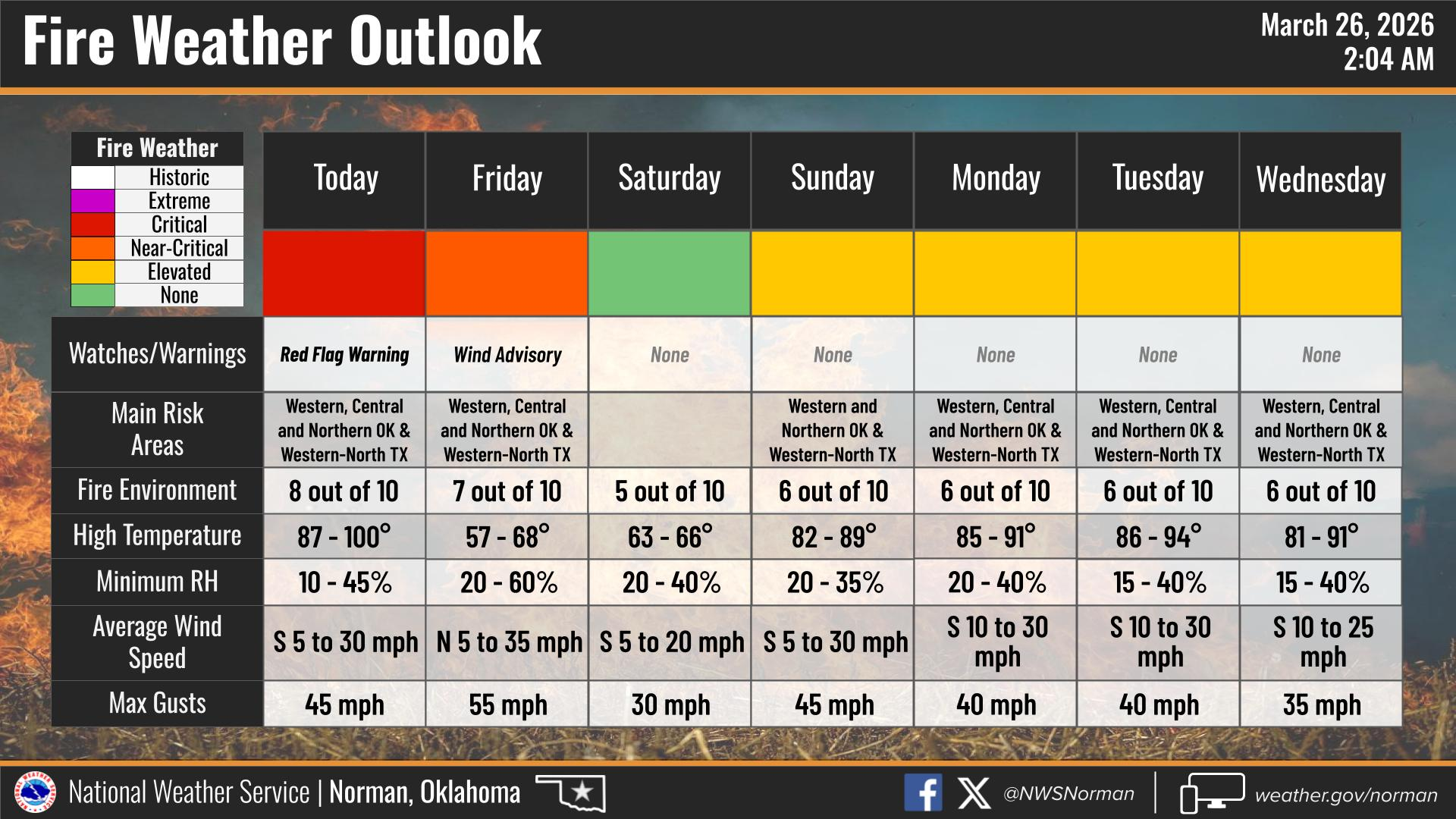
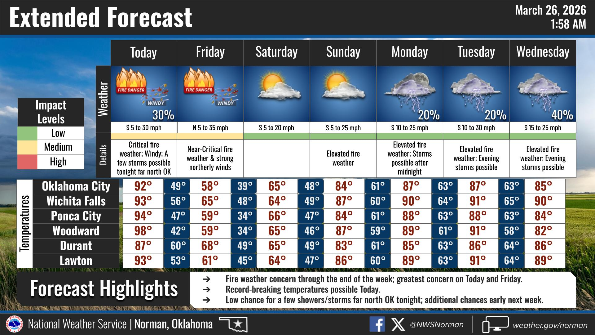
THURSDAY WEATHER OUTLOOK FROM GARFIELD COUNTY EMERGENCY MANAGEMENT – 3/26/26
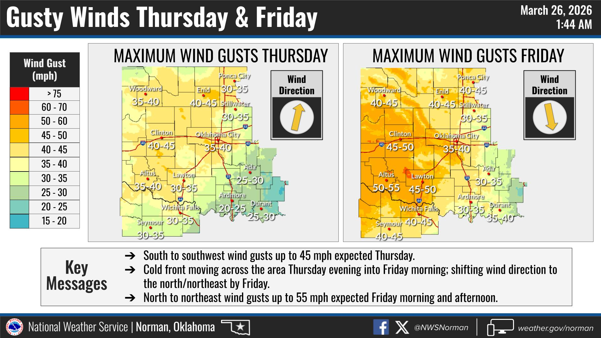
It’s a hot, windy, and dangerous fire weather day across the county. Highs are climbing up into the mid-90s with strong south winds running 20 to 30 mph and gusts pushing up around 50 mph. It’s going to be one of those days where anything lightweight won’t stay put for long.
🔥 Red Flag Warning (Today 9 AM – 10 PM):
We are under a Red Flag Warning today, meaning critical fire weather conditions are in place. Low humidity, hot temps, and strong winds will allow any fire to spread extremely fast. Absolutely avoid burning today and be careful with anything that could spark.
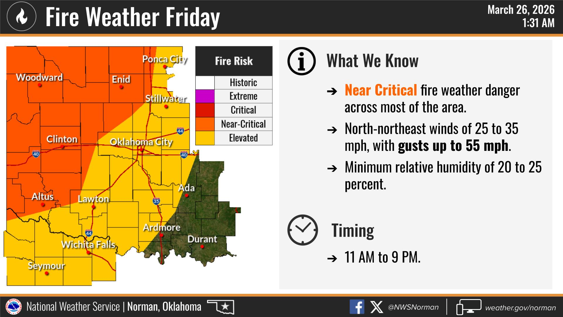
💨 Wind Advisory (Midnight – 7 PM Friday):
The wind isn’t going anywhere. A Wind Advisory kicks in overnight and runs through tomorrow evening, with continued strong winds even as temperatures drop.
🌙 Tonight:
We’ll start off mostly clear, then clouds increase with a slight chance of showers after midnight (20%). Big temperature swing with lows dropping into the mid-40s, and winds shifting around to the northeast and staying gusty up to around 45 mph.
👉 Bottom line: Today is all about the wind and fire danger. Stay alert, hold off on any burning!
Have a great Day!
Jacob Price EM-1