WEATHER UPDATE FROM GARFIELD COUNTY EMERGENCY MANAGEMENT – 4/9/2026
Good afternoon, everyone, we just wrapped up our Thursday briefing with the NWS Norman, and overall, not a lot has changed with the upcoming severe weather setup.
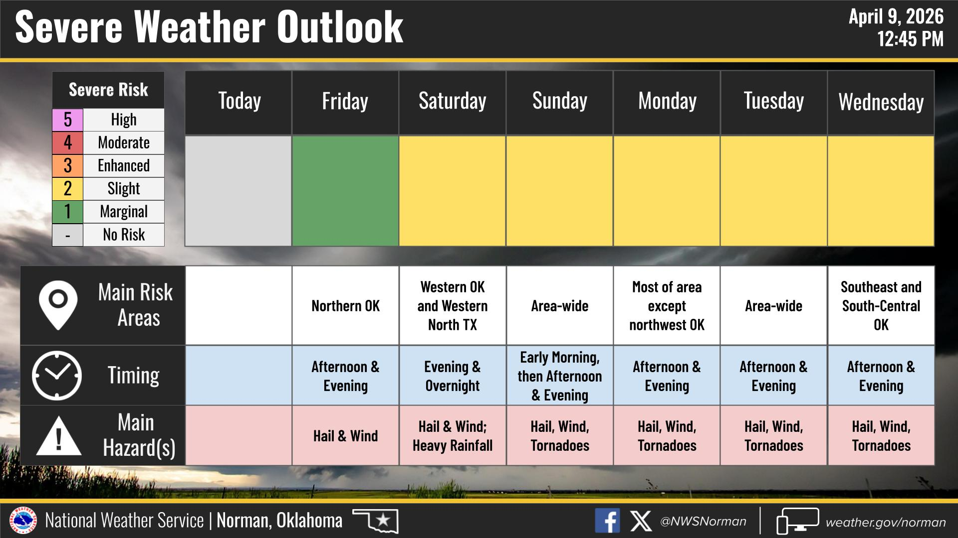
We’re about to shift into a much more active pattern starting tomorrow afternoon and evening, and it looks like this could carry us through at least the middle of next week.
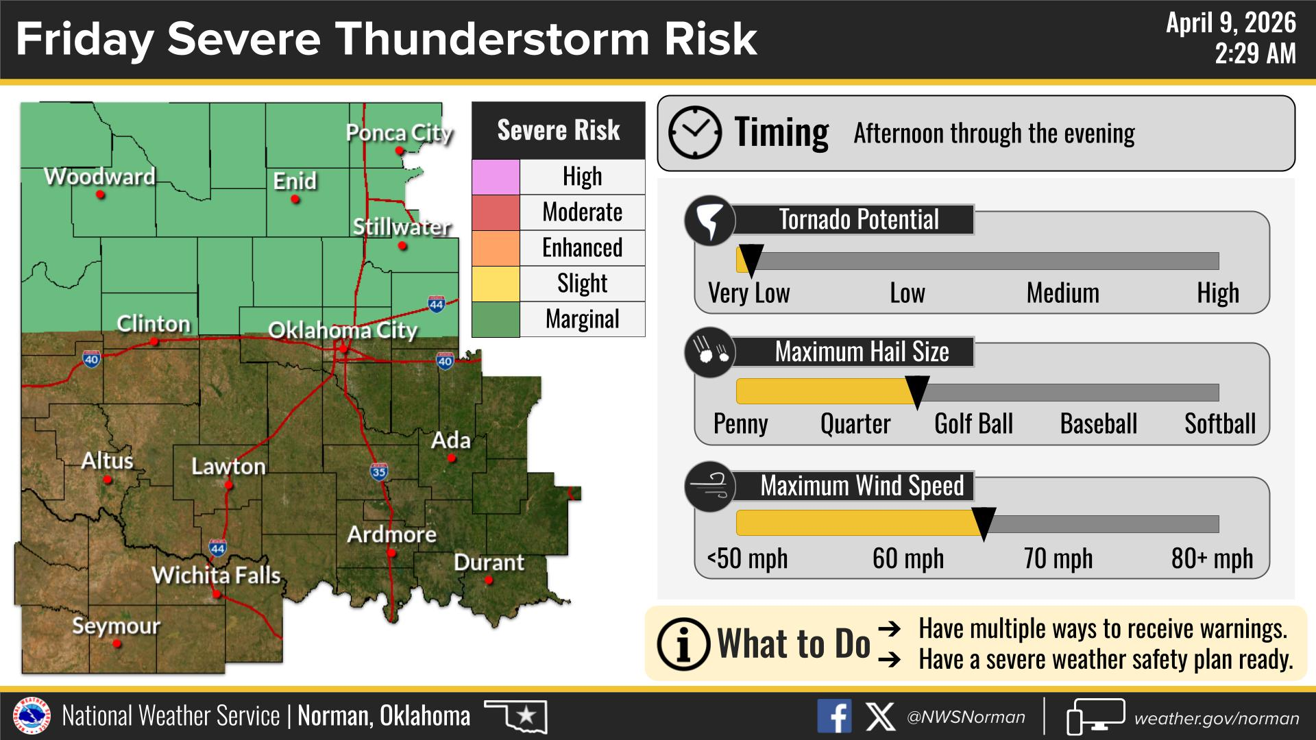
Friday: tomorrow remains a marginal risk for severe weather. Main threats will be quarter to golf ball size hail and 60–70 mph wind gusts. The tornado threat isn’t zero, but it remains very low at this time.
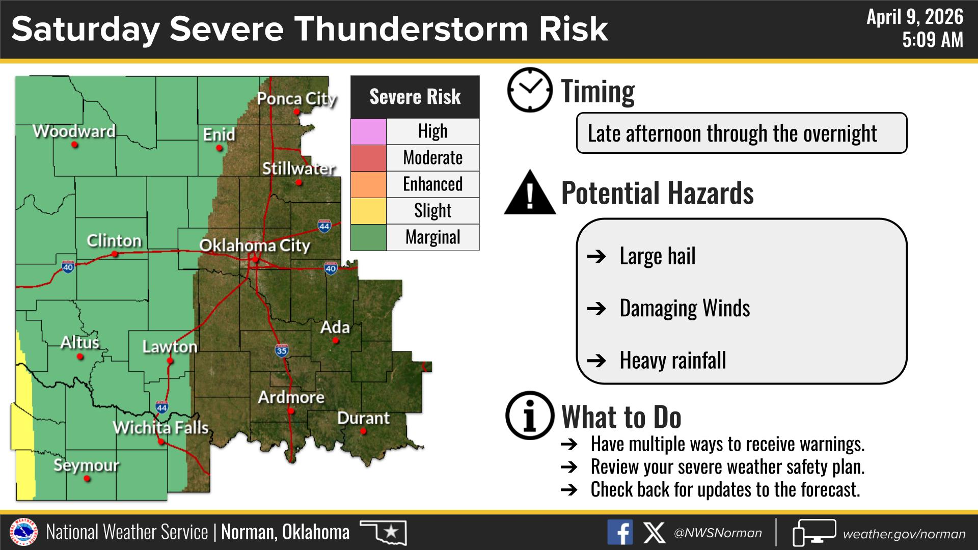
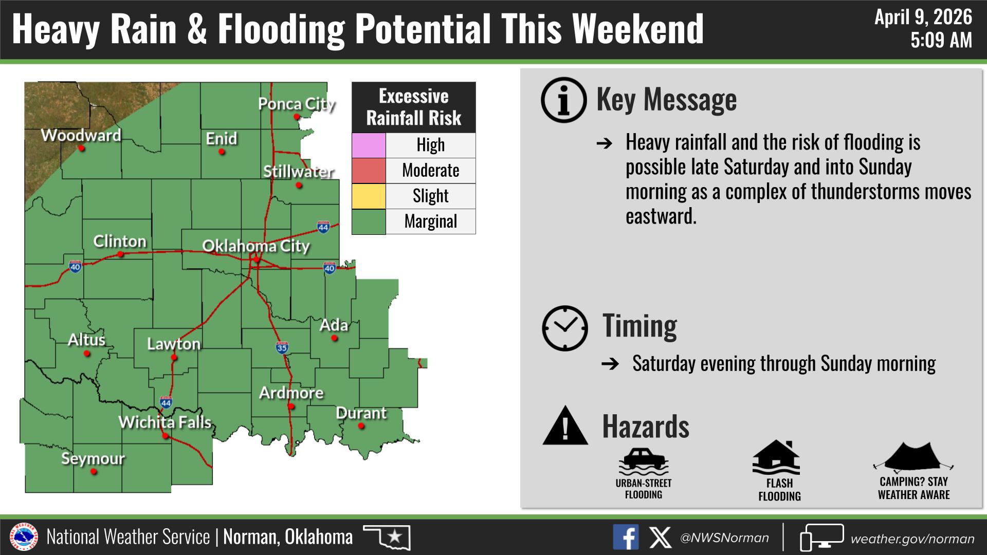
Saturday: Another marginal-type day is shaping up. If storms develop later in the afternoon into the evening, we’ll again be watching for large hail, damaging winds, and some heavy rainfall.
Sunday through Tuesday: This is the period we’re watching the closest. These look to be our higher-end severe weather days, with all modes of severe weather possible. We’ll continue to gather details as we get closer, but this is a time frame you’ll want to stay weather aware.
Looking a bit longer range, the pattern suggests that mid to late April could stay pretty active across our area.
Official Forecast from NWS Norman:
This Afternoon: Sunny and breezy with temperatures holding near 80°. South winds 20 to 25 mph with gusts up to 40 mph.
Tonight: Mostly clear early, then becoming partly cloudy with a slight chance (20%) of showers and thunderstorms after midnight. Breezy with lows in the upper 50s. South winds 15 to 25 mph, easing to 10 to 15 mph overnight.
Enjoy the rest of your day!
Jacob Price EM-1