Weekend Weather Outlook From Garfield County Emergency Management 11/13 Thru 11/15:
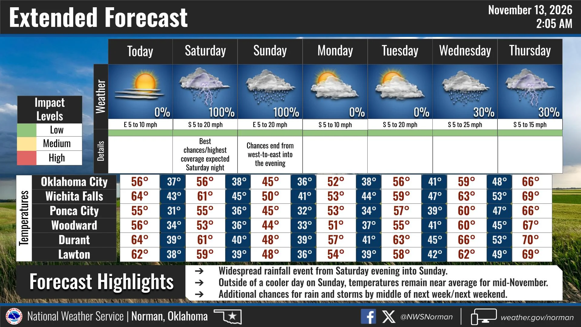
We have a nice day ahead today with sunny skies and highs in the lower 50s. Temperatures will drop into the lower 30s tonight.
Saturday will start out partly sunny before clouds increase throughout the day. Highs will reach the mid 50s, with southeast winds gusting up to 25 mph.
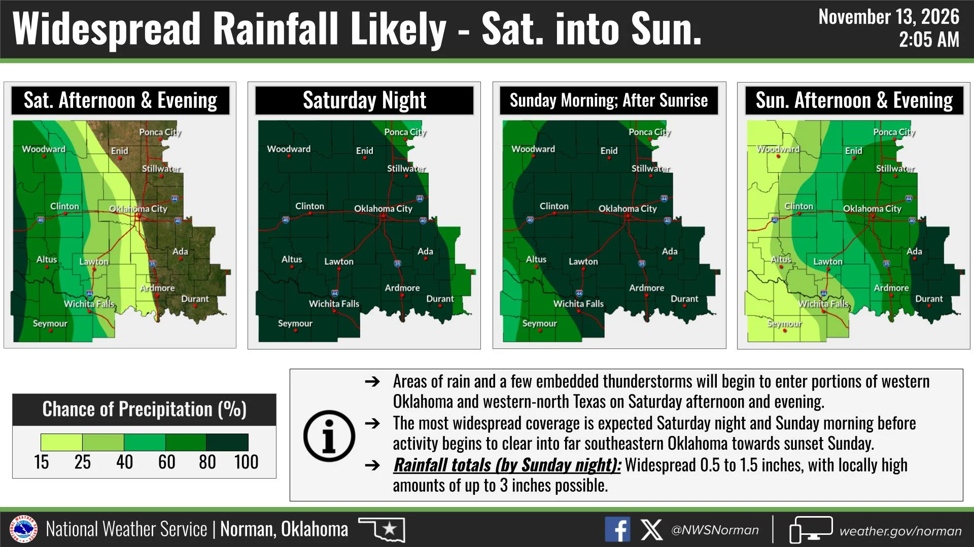
Rain chances will begin increasing Saturday afternoon and evening as showers and a few embedded thunderstorms move into western Oklahoma. The best chances for widespread rainfall across our area will be Saturday night into Sunday morning.
Rain will continue through much of Sunday before gradually shifting east and beginning to clear out by Sunday evening.
Rainfall Potential:
- Widespread rainfall totals of 0.5 to 1.5 inches are expected.
- Locally higher amounts of up to 3 inches are possible.
Sunday will be cooler, with highs only reaching the mid 40s.
Overall, this looks like a good opportunity to receive some beneficial rainfall across the area. We’ll continue monitoring the forecast, especially for any changes in rainfall amounts or thunderstorm potential.
Have a Great Weekend!
Jacob Price,
Director of Garfield County Emergency Management