FROM GARFIELD COUNTY EMERGENCY MANAGEMENT-SATURDAY-10/14/17
Now would be a good time to download our emergency app-GARFIELD COUNTY EM– You may need it later today.
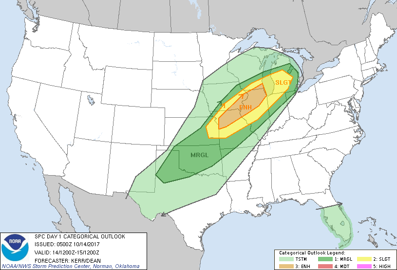
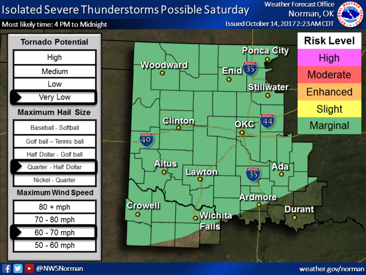
ADVISORY: We are in a MARGINAL RISK for severe weather later today. Timing appears to be from 4 pm until midnight. Large hail and winds to 70 mph are possible. The tornado threat is low. No need to panic about this right now. A cold front will push through the area later today and the timing on this will determine what actually will happen. There are too many details to put into this post but just stay weather aware later today and I’ll advise as needed. See the attached pics.
Here is your forecast from the NATIONAL WEATHER SERVICE/NORMAN;
Today-30 percent chance of showers and thunderstorms after 1pm. Partly sunny, with a high near 88. South southwest wind 10 to 20 mph increasing to 20 to 25 mph in the afternoon. Winds could gust as high as 35 mph.Tonight-Showers and thunderstorms, mainly before 1am. Low around 47. South southwest wind 10 to 20 mph becoming north 20 to 25 mph in the evening. Winds could gust as high as 35 mph. Chance of precipitation is 90%. New rainfall amounts between a quarter and half of an inch possible.
NWS WARNINGS AUTOMATICALLY COME THROUGH OUR APP. ADVISORIES COME FROM ME.
HAVE A GREAT DAY.
MIKE