0420L-FRIDAY UPDATE FROM ENID/GARFIELD COUNTY EMERGENCY MANAGEMENT-4/6/18
AT 0200L AN ACCIDENT OCCURRED ON NORTH 132 BETWEEN BUFFALO AND BLAINE ROADS INVOLVING A CATTLE TRUCK. RESPONDERS ARE STILL ON SCENE AT THIS TIME 0405L AND EXPECT TO REMAIN ON SCENE UNTIL AT LEAST 0600L. AVOID THAT AREA IF POSSIBLE.
1- FREEZE WARNING from 9 pm “Friday night” until 10 am Saturday morning with a “chance” for freezing precip such as snow, freezing rain, and sleet overnight tonight. Amounts, if received, will be light per NWS GUIDANCE.
2- ARCTIC cold front will push through during the morning with high temps occurring early then cooling down the rest of the day. We could see temps in the mid 30’s by late this afternoon. After frontal passage, winds will become northeasterly 15-25 mph gusting to 35 or so.
3-Overall, we’ll be ok but take a coat and an umbrella, just in case, with you as you will need the coat later today. Here is your forecast from the NWS/NORMAN;
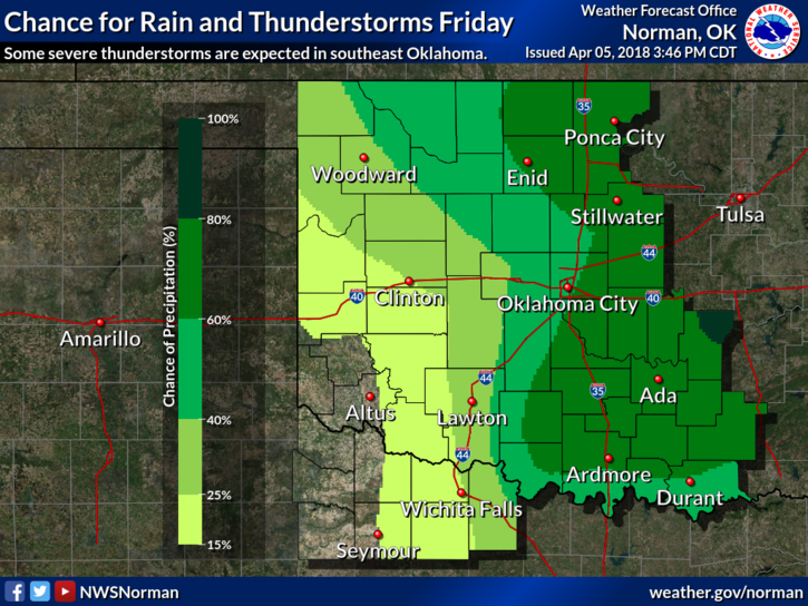
Friday… cloudy. showers likely, mainly in the morning. cooler. highs in the lower 50s. northeast winds 10 to 15 mph with gusts up to 25 mph increasing to 15 to 25 mph with gusts up to 35 mph in the afternoon. chance of showers 70 percent.
Friday night… cloudy. a slight chance of freezing rain, snow and sleet in the evening, then a chance of freezing rain, snow and sleet after midnight. much colder. lows in the lower 20s. north winds 10 to 20 mph with gusts up to 30 mph. chance of precipitation 40 percent.
HAVE A SUPER DAY AND BE CAREFUL.
MIKE