0435L-THURSDAY UPDATE FROM ENID/GARFIELD COUNTY EMERGENCY MANAGEMENT-4/5/18
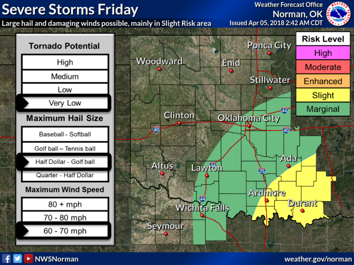
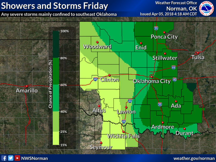
1– ENJOY TODAY’S WARMTH AS WINTER HAS DECIDED TO RETURN FRIDAY AND SATURDAY. There is a chance for rain Friday with the frontal passage and “possibly” snow “ Friday evening IF parameters come together. Timing is everything right now with moisture and boundaries. Per NWS guidance, there is a 50% chance for precip here on Friday. This most likely will change.
2- We will have low temps in the teens and twenties Saturday morning so be prepared for chilly conditions. At least highs will be in the 40’s and 50’s Saturday and Sunday.
3-Overall, we‘ll be ok. Just understand that APRIL is normally that month where winter and spring have a fight, so to speak, for dominance and we can see weather extremes during this timeframe. Extremes can happen anytime but April is usually our time for those. Early in the mornings, sit on the patio, drink coffee, and keep a coat handy. It’s all good.
4- Here is your forecast from the NWS/NORMAN;
Today-Mostly cloudy during the morning, then sunny during the afternoon, with a high near 71. South southwest wind 8 to 18 mph, with gusts as high as 25 mph.
Tonight-Partly cloudy, with a low around 43. Southeast wind 6 to 8 mph becoming east northeast after midnight.
HAVE A SUPER DAY!!
MIKE