0345L-FRIDAY OUTLOOK FROM GARFIELD COUNTY EMERGENCY MANAGEMENT-12/11/2020
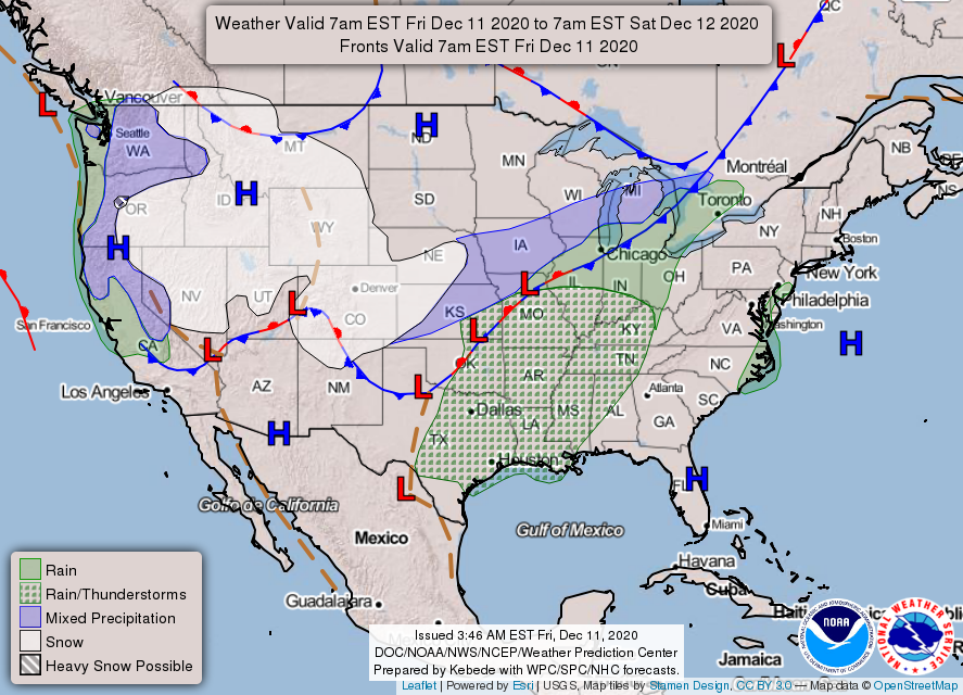
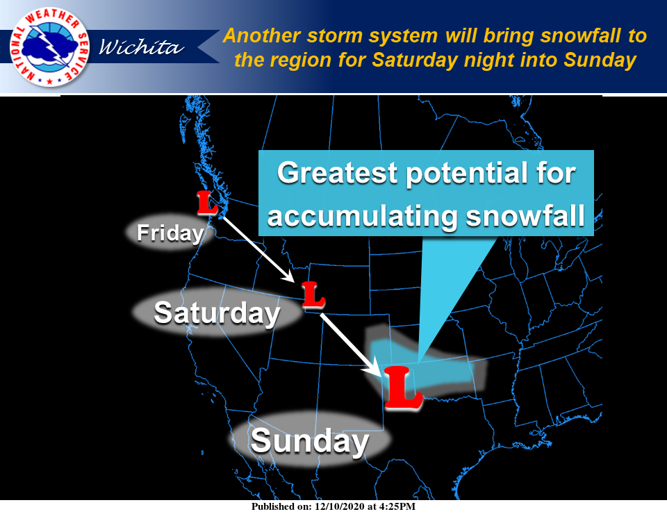
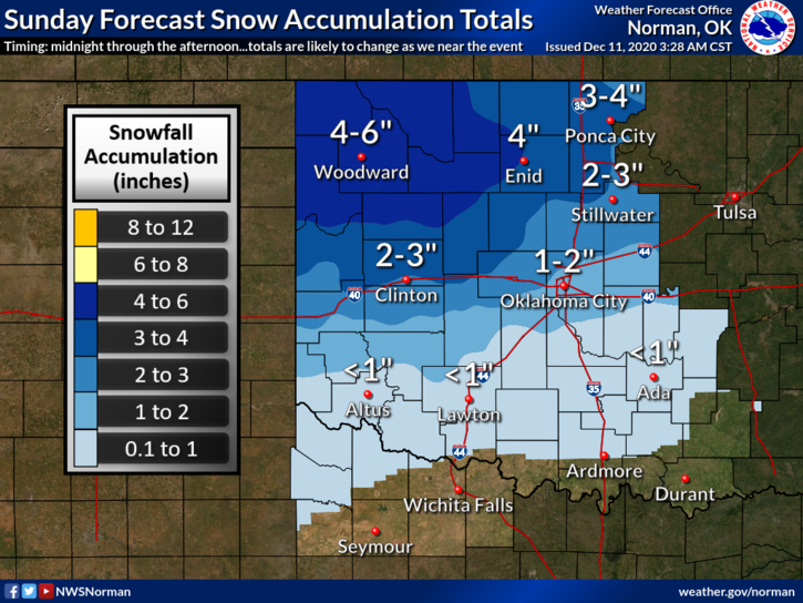
1-Several storm systems will affect the area over the next 5 days. One is working southeast now bringing light rain east and southeast of here. Today will be cloudy and quite a bit cooler. Rain chances are low. Saturday evening through Sunday morning we could see SNOW if the storm track comes through the area. That still hasn’t been set in stone yet so we’ll see where that track ends up. There may be a better picture on this later today.
2- IF and I repeat IF we see any snow Saturday night, we could receive 1-4 inches, again DEPENDING ON THE STORM TRACK. Another system will push through on Tuesday with another chance for precipitation. We’ll see what happens.
3- We are still abnormally dry so be careful with anything related to fire. Call 911 if you happen to see smoke and/or fire. Overall, we’ll be ok so here is your forecast from the NWS/NORMAN for today;
TODAY-Mostly cloudy, with a high near 44. North northwest wind around 14 mph, with gusts as high as 20 mph.
TONIGHT-Partly cloudy, with a low around 31. Northwest wind 11 to 13 mph.
4- Be sure to download our GARFIELD COUNTY EM app. It’s loaded with information that can keep you safe and help you be as PREPARED as possible. PREPAREDNESS=RESILIENCE
NOTE- I have added a few graphics from the Wichita and Dodge City NWS offices. Norman’s are from late yesterday. I will update these later.
HAVE A GOOD DAY!
MIKE