0330L-FRIDAY OUTLOOK FROM GARFIELD COUNTY EMERGENCY MANAGEMENT-6/4/21
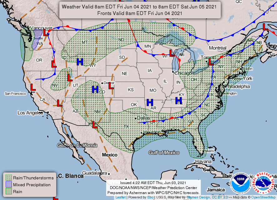
1- We are not under a thunderstorm risk area again today. This doesn’t mean that we won’t see a shower or two later this afternoon. The ground is moist and diurnal heating could cause enough lift to fire off a few showers as it did yesterday. If you notice the thicker clouds around as we reach mid to late afternoon, there might be a shower or two out there. They may cause torrential rainfall in small areas and actually produce lightning. Just be weather aware.
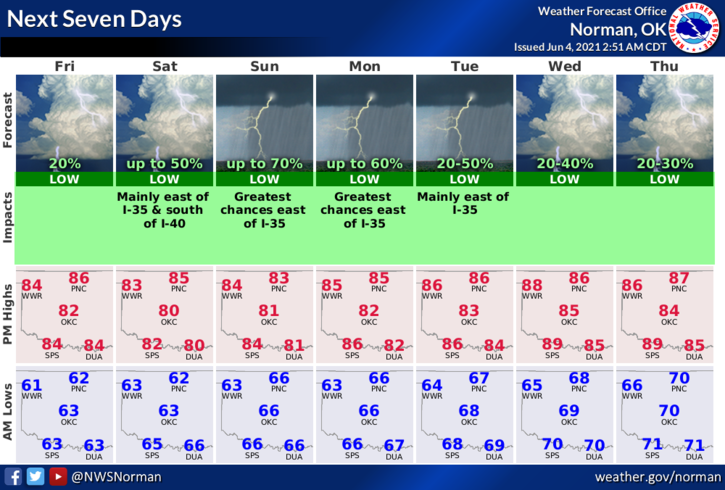
2- Sunshine, for the most part, are in the cards for today and Saturday so get out and absorb some before rain chances increase later this weekend into next week. Overall, we’ll be ok so here is your forecast from the NWS/NORMAN;
Today-Mostly sunny. Highs in the mid-80s. South winds 10 to 15 mph.
Tonight-Mostly clear. Lows in the lower 60s. South winds 10 to 15 mph.
IMPORTANT INFORMATION- I will be posting INFO throughout June and early July concerning fireworks. It is illegal to fire them off in specific areas. Since harvest looks like it may be pushed back some due to the rain in recent weeks, it will make things harder for folks to enjoy fireworks that they buy. County roads are a no-no and especially near crops like wheat, corn soybeans, etc. Make sure you have permission from a landowner if you decide to do fireworks on private property and it would be a good idea to have it in writing. Forgeries could get you arrested. Just sayin. I will post the law over this month as we don’t want a farmers crop destroyed because of negligence.
Have a good day!!
MIKE