0300L-FRIDAY OUTLOOK FROM GARFIELD COUNTY EMERGENCY MANAGEMENT-3/31/23
*RED FLAG FIRE WARNING IN EFFECT FROM 10 AM UNTIL 10 PM TONIGHT
*WIND ADVISORY IN EFFECT FROM 10 AM UNTIL 8 PM TONIGHT
* The above comes with risks:
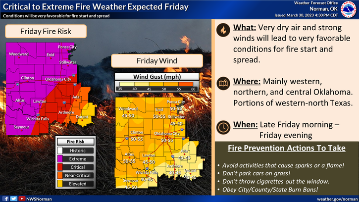
RED FLAG WARNING: Wind gusts upwards of 55 mph, Humidity as low as 8%, any fire that gets started will move rapidly. No burning of any kind today, please.
WIND ADVISORY: West winds 25-35 mph gusting as high as 55 mph, unsecured objects will be blown around, extreme caution is advised to drivers especially high profile vehicles.
* The threat for severe weather still exists for areas east and south of an Enid to Wichita Falls line. If storms do occur, they could be severe. Most likely time would be around daybreak. A dryline and front will push this moisture that moved in yesterday and usher in very dry air. It almost has nosebleed potential with the dry air.
*Overall, we’ll be ok. Use EXTREME CAUTION while driving and be careful out there. Here is your forecast from the NWS/NORMAN:
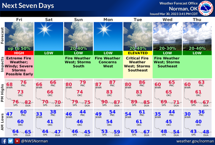
Today- Sunny. A chance of showers and thunderstorms this morning. Very windy with highs in the mid-70s. Southwest winds 20 to 25 mph with gusts up to 40 mph, becoming west 25 to 35 mph with gusts up to 55 mph this afternoon. Chance of rain 30 percent.
Tonight- Mostly clear. Much cooler with lows in the upper 30s. West winds 15 to 20 mph with gusts up to 40 mph, becoming northwest 10 to 15 mph after midnight.
HAVE A GOOD DAY!