0330L-FRIDAY OUTLOOK FROM GARFIELD COUNTY EMERGENCY MANAGEMENT-5/20/22
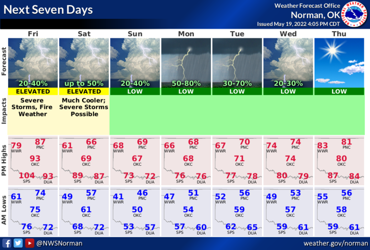
1- Here is your forecast from the NWS/NORMAN;
Today- Sunny. Highs in the mid-80s. West winds 15 to 20 mph with gusts up to 35 mph, becoming north with gusts up to 25 mph in the afternoon.
Tonight-Partly cloudy in the evening, then becoming mostly cloudy. A slight chance of showers and thunderstorms. Cooler with lows in the mid-50s. Northeast winds 10 to 15 mph with gusts up to 25 mph. Chance of rain 20 percent.
2- Warm today then cooler air filters in for the weekend as a cold front will move through the area this morning. We are looking at HIGH temps over the weekend being in the mid-60s through Tuesday and LOW temps in the 50s. Mother nature appears to still be in control.
3- There is a slight possibility that we may see some thunderstorms later today as all the ingredients are in place for this risk. If storms do occur, winds and hail would be our threats. We’ll see where the storms actually form this afternoon.
4- Overall, we’ll be ok so enjoy the cooler temps and HAVE A GOOD DAY!