0315L-FRIDAY OUTLOOK FROM GARFIELD COUNTY EMERGENCY MANAGEMENT-11/12/21
1- FREEZE WATCH IN EFFECT FROM 2300L THIS EVENING THROUGH 0900L SATURDAY MORNING. Low temps in the upper 20s are possible. Take all possible precautions to prevent freezing of pipes, your car’s cooling system, etc.
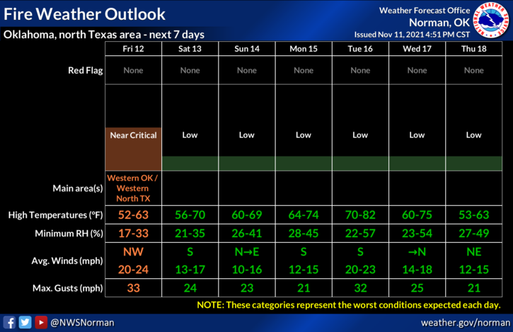
2-The FIRE DANGER increases today with dry air, low humidity, and strong winds. CONTROLLED BURNING IS “NOT” ADVISED. If anyone sees smoke or fire, call 911 immediately so the proper response can be sent.
3-Overall, we’ll be ok and keep in mind that we’ll see several fronts this week push through the area. Here is your forecast from the NWS/NORMAN;
Today-Partly cloudy early in the morning then clearing. Highs in the mid-50s. Northwest winds 15 to 25 mph with higher gusts.
Tonight-Clear, colder. Lows in the mid-20s. Northwest winds 10 to 15 mph in the evening becoming light and variable.
Stay safe