0400L-FRIDAY UPDATE FROM ENID/GARFIELD COUNTY EMERGENCY MANAGEMENT-10/12/18
DOWNLOAD OUR “GARFIELD COUNTY EM” APP & BE PREPARED. IF YOU DON’T HAVE IT, YOUR NOT.
OCTOBER 30, 2018- 2ND ANNUAL DISASTER RESILIENT SEMINAR. SEE INFORMATION HALFWAY DOWN THE FRONT PAGE AND RSVP: https://gcem.org
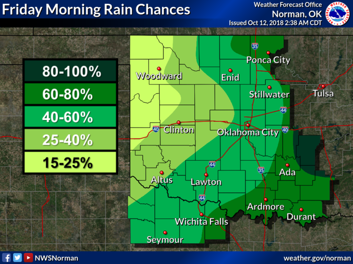
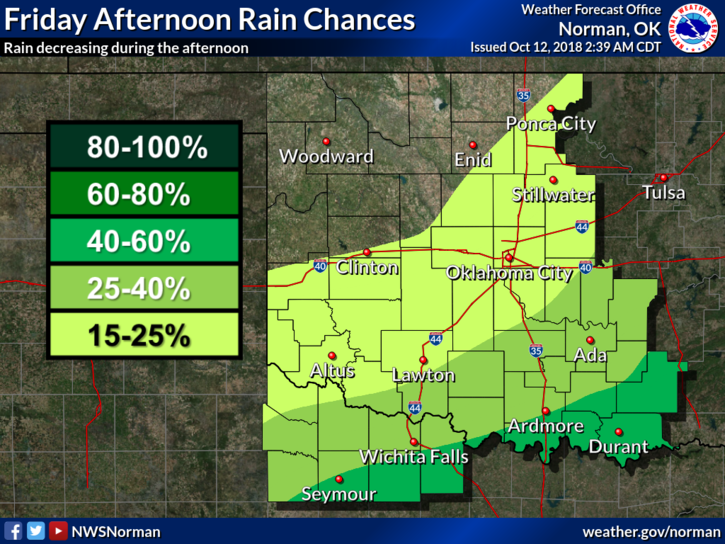
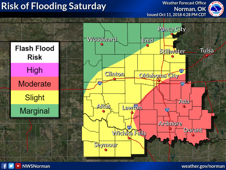
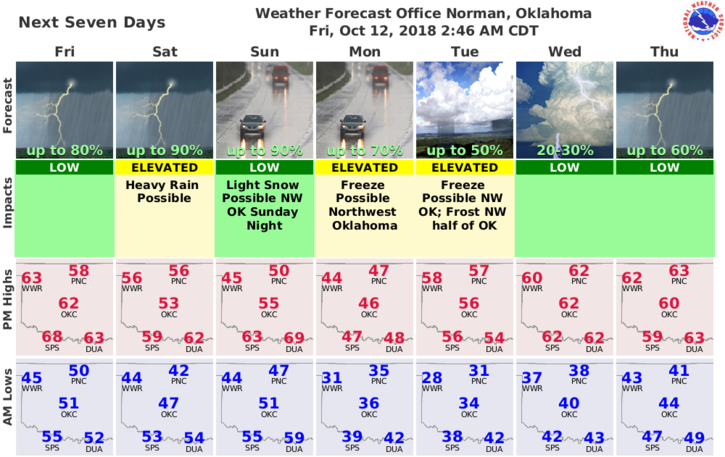
1-Showers are possible this morning. A cool front comes through this afternoon. Prepare for cooler weather. Rain is in the picture all weekend but it won’t rain all of the time.
2- Saturday-technically a transition day.
3- Sunday, another cold front, this time with MUCH COLDER AIR will push in and with moisture in place we stand to see a wintry mix during the overnight hours. We could also see our first freeze Monday or Tuesday morning.
4- You can go here to freshen up your memory on what to do during cold weather: https://www.weather.gov/safety/cold
5-Here is your forecast from the NWS/NORMAN;
Friday-Showers likely, mainly before 10am. Mostly cloudy, with a high near 61. Southeast wind 5 to 10 mph becoming northwest in the afternoon. Chance of precipitation is 60%. New precipitation amounts of less than a tenth of an inch possible.
Friday Night-Mostly clear with a low around 43. North northeast wind 5 to 10 mph becoming light and variable after midnight.
Have a great day!!
MIKE