0325L-FRIDAY OUTLOOK FROM GARFIELD COUNTY EMERGENCY MANAGEMENT-9/10/21
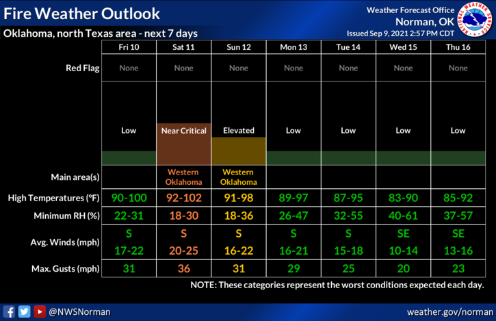
1-The FIRE DANGER is again slowly increasing and for today with our dew points temps in the mid-50s and humidity forecast to be in the mid-20s along with strong winds, and temps in the upper 90s, this might be an interesting weekend. If anyone sees smoke and fire, call 911 so the proper response can be sent.
2-SMOKE from the fires in the western US will continue in the mid/upper levels and cause a haziness possibly holding down forecast temps a bit. Sunrise and sunsets will be colorful. Overall, we’ll be ok but anyone that utilizes any fire related equipment should use extreme caution today. I would advise that CONTROLLED BURNING be put on HOLD since winds will be higher than 15 mph.
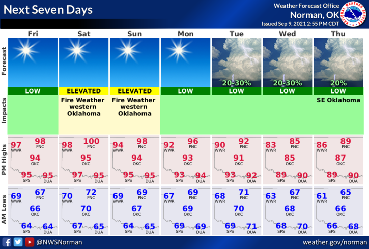
3- Here is your forecast from the NWS/NORMAN;
Friday-Sunny and hot, with highs near 99. South wind 10-20 mph, with gusts as high as 28 mph.
Friday Night-Clear. Low around 70. SSW wind 10 to 15 mph, with gusts as high as 21 mph.
FINALLY, Remember to keep yourselves hydrated since we will still be pretty hot out there.
STAY SAFE!
MIKE