MONDAY OUTLOOK FROM GARFIELD COUNTY EMERGENCY MANAGEMENT-4/22/19
First of all, remember that storms have occurred for millions of years. We can’t stop them. It’s important that you learn the basic dynamics of storms so you understand what may or may not occur. The more you know and understand, hopefully, the less you’ll fear them.
Download our GARFIELD COUNTY EM app. Understanding what’s going on starts with this app.
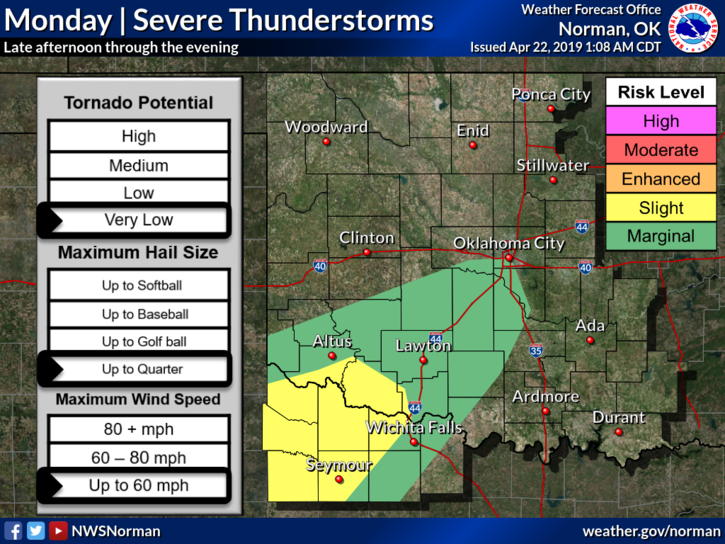
1- Thunderstorms are back in the forecast for tonight and Tuesday. The severe threat is low for us. We have a cold front, dryline, and storm system once again and it appears the heavy weather will be to our southwest. We know that the remnants will affect us so IF it rains, enjoy it and the light show.
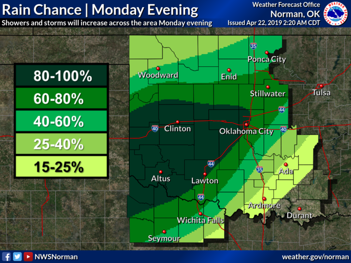
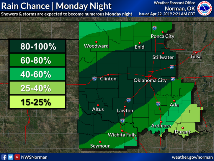
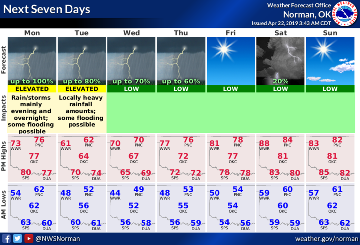
2- The graphics attached will change some during the day. We’ll see what happens. Here is your forecast from the NWS/NORMAN;
Monday-Partly sunny, with a high near 77. South wind 6 to 10 mph becoming north in the afternoon.
Monday Night-Showers and thunderstorms likely, then showers and possibly a thunderstorm after 1am. Low around 53. North northeast wind 6 to 9 mph. Chance of precipitation is 80%. New rainfall amounts between a quarter and half of an inch possible.
HAVE A GOOD DAY!!
MIKE