0415L-MONDAY UPDATE FROM GARFIELD COUNTY EMERGENCY MANAGEMENT-2/19/18
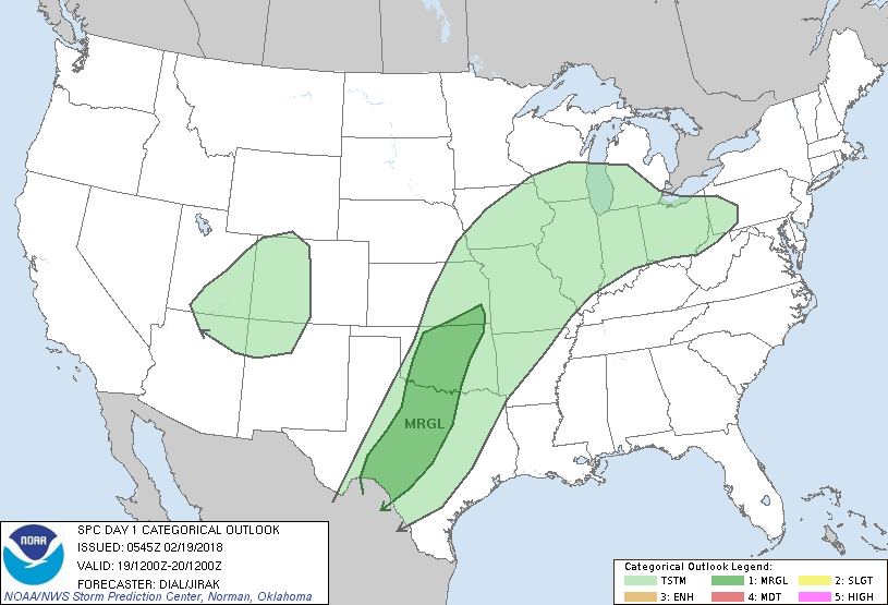
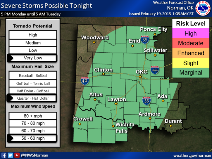
1-We are in a MARGINAL RISK for possibly some severe weather later today into the overnight hours. DON’T PANIC!! We’ve been here before and as of right now, our biggest threat would be hail and winds. There are still a few questions on boundaries right now as to where they’ll end up at a given time so this WILL change later today.
2-Download our GARFIELD COUNTY EM app as I will send out an advisory over it later this morning and again this afternoon based on the latest guidance from the NWS/NORMAN.
3-Models are not in agreement for the Thursday timeframe so don’t get wound up on the freezing precip right now. The forecast will change some so another day or so will give us a better picture of what MAY HAPPEN.
4- Here is your forecast from the NWS/NORMAN;
MONDAY… mostly cloudy with a slight chance of showers and thunderstorms. Warmer with highs in the lower 70s. South winds 15 to 20 mph. Chance of precipitation 20 percent.
Monday night… mostly cloudy with isolated thunderstorms. Slight chance of showers in the evening, then showers likely after midnight. Lows in the upper 50s. South winds 15 to 20 mph with gusts up to 30 mph. Chance of precipitation 70 percent.
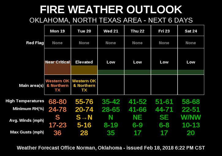
5-The BURN BAN is still in effect and the FIRE DANGER is ELEVATED.
Have a great day!!
MIKE