0340L-MONDAY OUTLOOK AND INFO FROM GARFIELD COUNTY EMERGENCY MGMT-1/13/2020
1- LIGHT FREEZING FOG IS POSSIBLE THIS MORNING. If it develops and becomes dense, elevated surfaces like bridges and overpasses could be affected. Use extreme caution while driving.
2- Windy conditions will become a factor again today as the fire danger will be elevated. No Controlled burning today please. Along these lines, if you see smoke or fire, call 911 asap so a response can be sent.
3- Overall, the sun should shine so get outside somewhere out of the wind and enjoy the warmth of the sun.
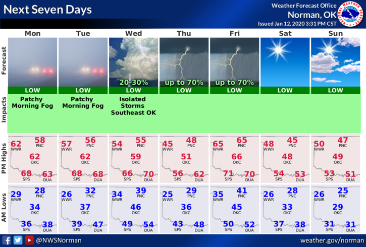
Here is your forecast from the NWS/NORMAN;
Monday-Patchy fog before 9am. Patchy freezing fog before 9am. Otherwise, mostly sunny, with a high near 59. South wind 10 to 15 mph increasing to 16 to 21 mph in the afternoon. Winds could gust as high as 29 mph.
Monday Night-Partly cloudy, with a low around 31. South wind 5 to 15 mph becoming north after midnight.
HAVE A GOOD DAY!
MIKE