FROM GARFIELD COUNTY EMERGENCY MANAGEMENT
Be sure to download our emergency app-GARFIELD COUNTY EM-It just might SAVE YOUR LIFE!
PLEASE PASS THIS STATEMENT AROUND- STORM SIREN TEST IN ENID TODAY AT 12 NOON. They will run the full 3 minutes. Let me know if HEAR THEM “outside” in your area. Remember, these are OUTDOOR warning devices.
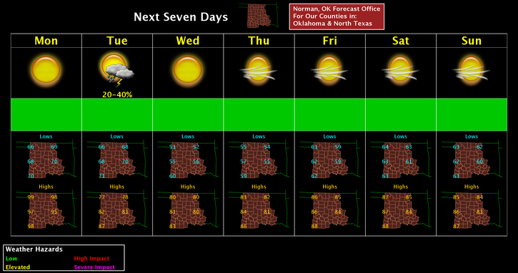
Summer is not quite over with yet with forecast highs today in the upper 90’s to low 100’s in the area. Be careful if working outside. We are expecting a cold front to move in late tonight and there is a chance for thunderstorms after frontal passage. Nothing severe is anticipated. Low temps Tuesday night could get as low as the upper 40’s to mid-50’s.
Here is your forecast from the NWS/NORMAN;
Labor Day-Sunny and hot, with a high near 98. South wind 5 to 8 mph.
Monday Night-Mostly clear, with a low around 68. East northeast wind 5 to 10 mph becoming north northeast 11 to 16 mph after midnight. Winds could gust as high as 23 mph.
HAVE A SUPER DAY!!
MIKE
In the face of disaster, YOU may become a FIRST RESPONDER. Are you PREPARED?