0305L-SATURDAY OUTLOOK FROM GARFIELD COUNTY EMERGENCY MANAGEMENT-8/26/23
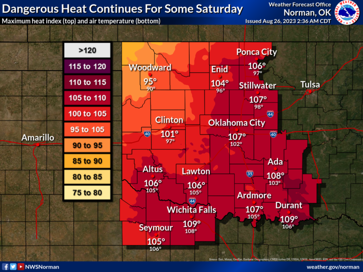
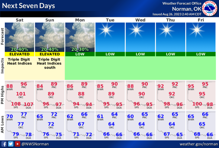
*HEAT ADVISORY in effect today from 11am until 8pm. The Heat index is expected to be around 104 with high temps in the upper 90’s. Today should be the last day for any heat advisories for a while as a cool front will work its way through the area and temps, after today, will average in the upper 80’s for the next 5 days or so. Not quite coat weather yet but the cooler temps will be welcome. There is a chance for rain later this evening. See the forecast below. We’ll see what happens.
*Drought conditions still exist here in the county so be careful out there if doing any burning. If you see smoke or fire, call 9-1-1.
*Overall, we’ll be ok, so here is your forecast from the NWS/NORMAN;
Today- Mostly sunny. Highs in the upper 90s. North winds 10 to 15 mph.
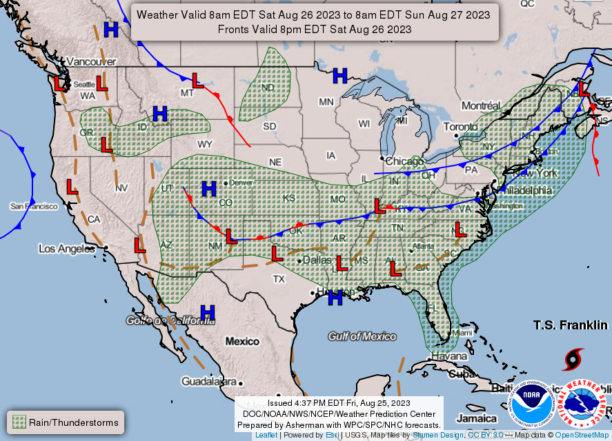
Tonight- Partly cloudy with isolated showers and thunderstorms in the evening, then mostly cloudy with scattered showers and thunderstorms after midnight. Humid with lows around 70. North winds 10 to 15 mph. Chance of rain 40 percent.
*This post can be found under GCEM Blog on the GARFIELD COUNTY EM app. It can also be found on the front page of our website at https://gcem.org
HAVE A GOOD DAY!