0305L-SUNDAY OUTLOOK FROM GARFIELD COUNTY EMERGENCY MANAGEMENT-8/27/23
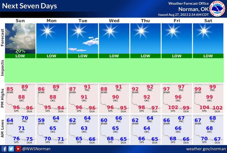
*Enjoy the lower temps for the next 4 days or so. Per guidance, we’ll return to the higher temps around Thursday into next weekend. Excessive heat indices will return. Until then, enjoy.
* The fire danger is still creeping up there so as I have been stating, use extreme caution if doing any outdoor burning.
*If you have been putting off winterizing your house because it’s been too hot for you to get outside, you could do these things this week and then you’re prepared when the cooler weather arrives maybe in a few months. Keep in mind that winterizing also helps save on your cooling bills in the summertime. All I am stating here is that temps will be better for doing these few things before we warm back up to excessive heat indices later this week.
*Overall, we’ll be ok so here is your forecast from the NWS/NORMAN;
Today- Mostly sunny. Highs in the upper 80s. North winds around 10 mph.
Tonight- Mostly clear. Lows in the lower 60s. Northeast winds 5 to 10 mph.
*This post can be found under GCEM Blog on the GARFIELD COUNTY EM app. It can also be found on the front page of our website at https://gcem.org
HAVE A GOOD DAY!