0415L-SATURDAY UPDATE FROM ENID/GARFIELD COUNTY EMERGENCY MANAGEMENT-11/22/18
1- WARM DAY WITH LIGHT WINDS OUT THERE. Be careful utilizing anything related to fire. Also, Read the graphs below carefully. Some are for later next week.
2- Tonight, we’ll have a trough move through the area and we should drop into the upper 20’s. There MIGHT be some precip with this system but we are very dry in the low levels. If you are up during the overnight hours, don’t be surprised if you see a snowflake.
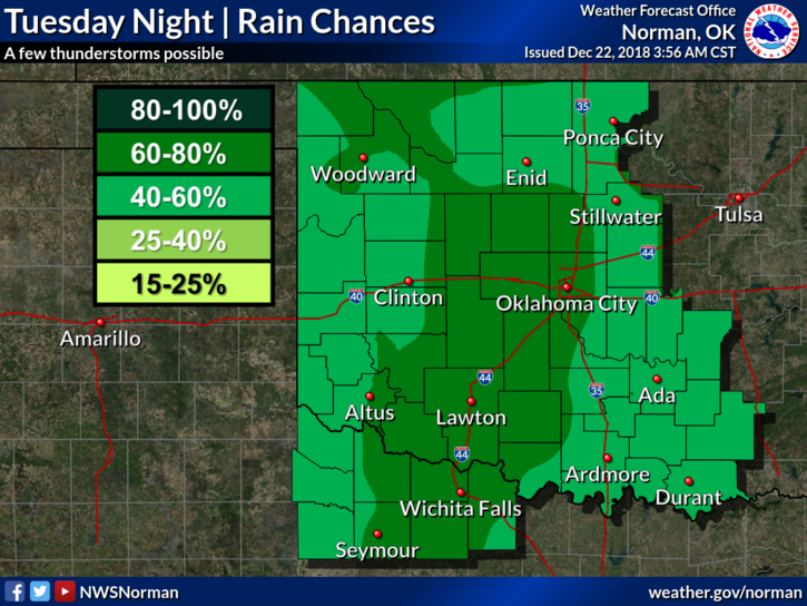
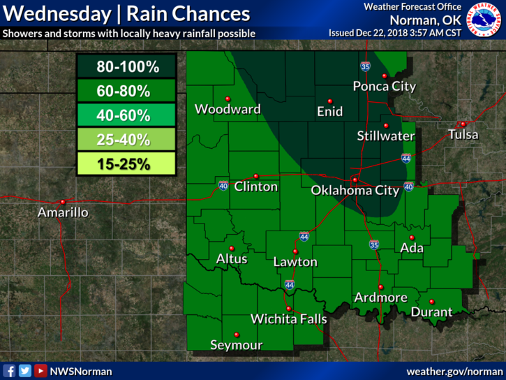
3- Overall, no major impacts from any weather until roughly mid-week where we may see some thunderstorm activity. This system is still at sea right now so I won’t say anything else until it reaches shore.
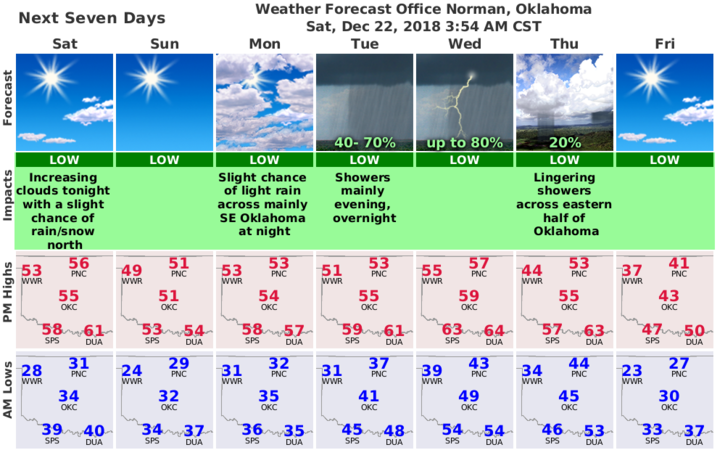
4- Here is your forecast from the NWS/NORMAN;
Today-Sunny. Highs in the mid 50s. North winds around 10 mph.
Tonight-Partly cloudy. A slight chance of snow after midnight. Lows in the upper 20s. North winds around 10 mph. Chance of snow 20 percent.
HAVE A SUPER DAY!!
MIKE