0400L-SATURDAY OUTLOOK FROM GARFIELD COUNTY EMERGENCY MANAGEMENT-1/9/21
1-NOTICE, I WILL NOT BE POSTING ON SOCIAL MEDIA UNTIL FURTHER NOTICE. Make sure you download our GARFIELD COUNTY EM app. You can find this post under GCEM BLOG on the app and on the front page of our website. PREPAREDNESS=RESILIENCE
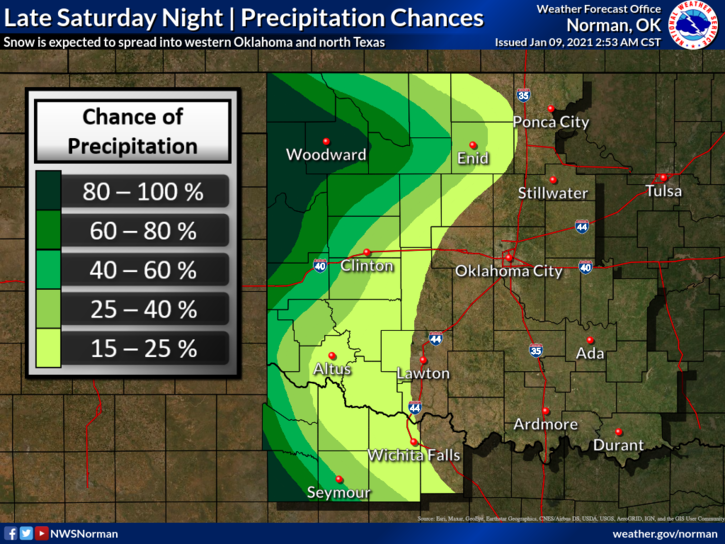
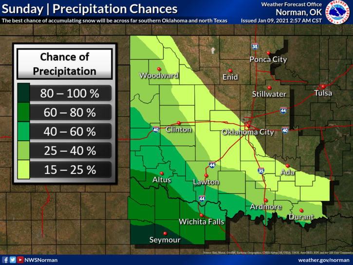
2- Being in a La Nina pattern in the past usually meant that we were warmer and dryer than normal. When the upper flow decides to shift near and also over us, we can have a winter. Guess what, we are having a winter. Another storm system will move in late tonight but will mainly affect counties out west and then southwest. We have a low chance here for any major accumulation of snow so keep this in mind. Snow is possible but very light.
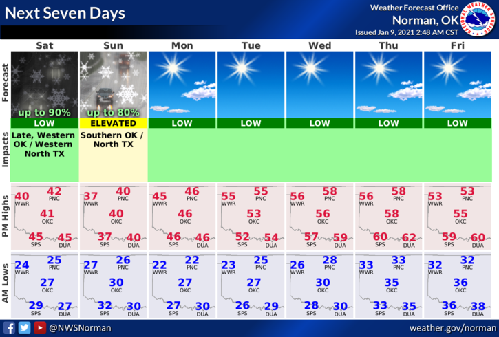
3- That said, here is your forecast from the NWS/NORMAN;
Today-Increasing clouds. Highs in the lower 40s. Light and variable winds.
Tonight-Mostly cloudy. A chance of snow after midnight. Lows in the upper 20s. Light and variable winds. Chance of snow 40 percent.
4- FINALLY- IF THE NATIONAL SITUATION GETS TOO FAR OUT OF CONTROL, WE WILL POST NEWS INFORMATION HERE.
HAVE A GOOD DAY!
MIKE