0340L-SATURDAY OUTLOOK AND INFO FROM GARFIELD COUNTY EMERGENCY MGMT-7/13/19
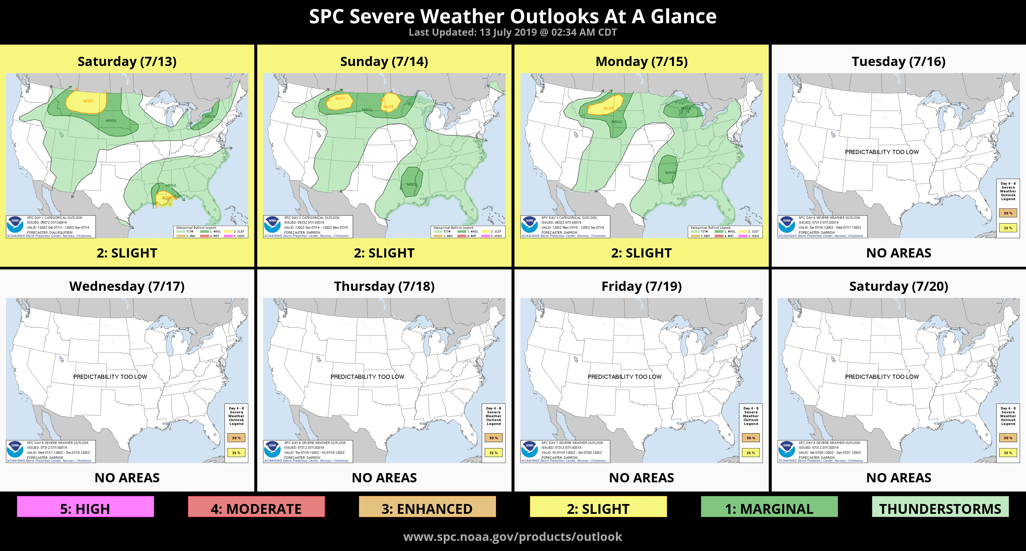
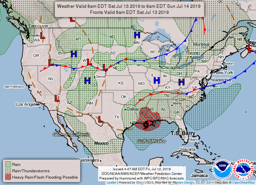
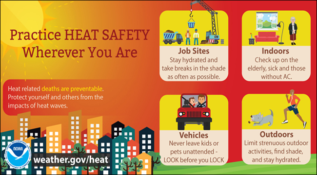
1- Enjoy the next couple of days as we will experience low winds and hot temps. Our highs will slowly increase as the forecast states. Rain chances have been introduced into far southeast Oklahoma and the path of TS BARRY is being watched closely. Any westerly change in direction could put rain back into our forecast and we would become oppressively hot again with high dew point temps leading to higher heat indexes. Hopefully all remnants stay east!
2- Please be careful utilizing anything related to fire. We are very dry even though we had all the rain several months ago. Notice I said months. Even though foliage is mostly green it is very dry so just stay cautious and report any fire to 911.
3- Here is your countywide forecast from the NWS/NORMAN;
Saturday- Mostly sunny with highs in the mid-90s. Light/variable winds becoming easterly around 10 mph in the afternoon.
Saturday Night- Mostly clear with lows in the upper 60s. East winds around 10 mph in the evening becoming light and variable.
STAY SAFE AND HAVE A GREAT DAY!!
MIKE