FROM GARFIELD COUNTY EMERGENCY MANAGEMENT-SATURDAY-10/21/17
DOWNLOAD OUR EMERGENCY APP-“GARFIELD COUNTY EM” IT JUST MIGHT SAVE YOUR LIFE!
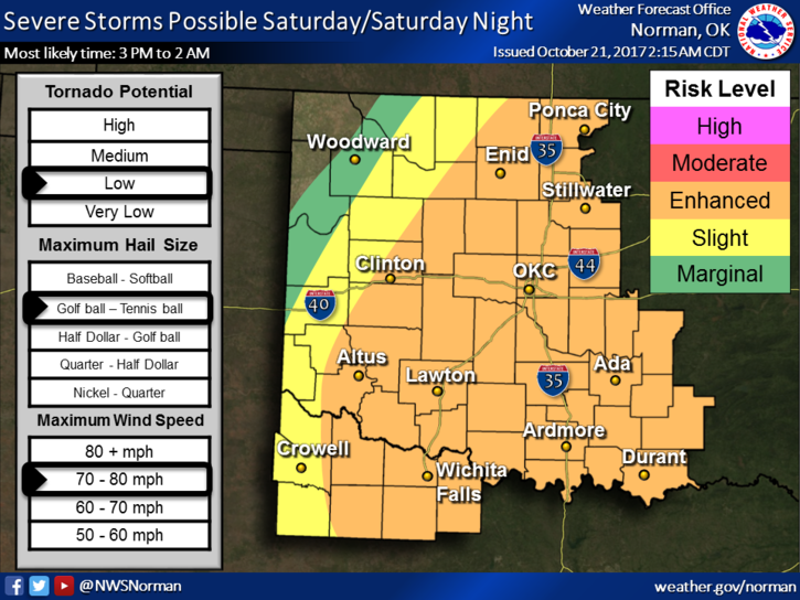
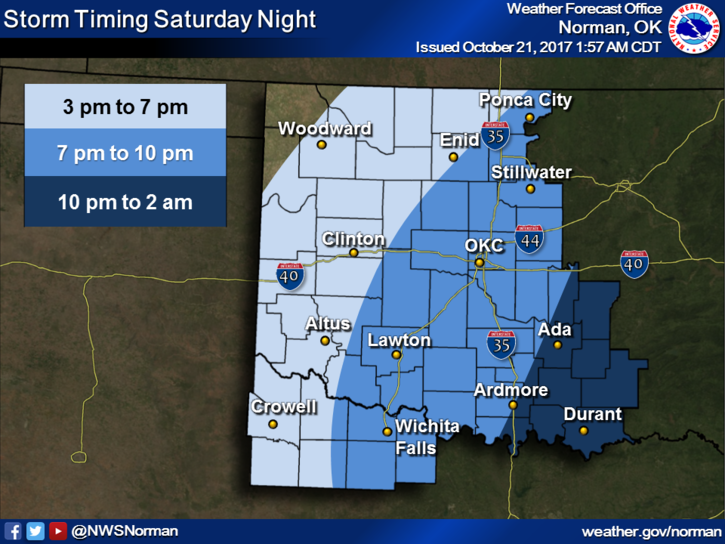
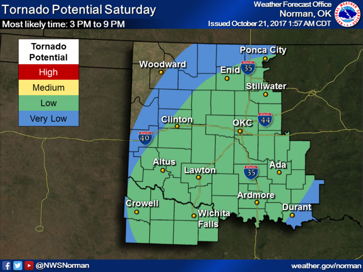
We are in an ENHANCED RISK for severe weather later this afternoon and tonight. See and read the graphs attached below. There is NO REASON for panic as we have lived through many enhanced risk days and even higher risk days in the past. This said, just be prepared for very strong winds, POSSIBLY large hail, and heavy rainfall later today into the evening hours.
Storms are expected to form ahead of the front and some may become supercells early then transition into a linear mode (a squall line) in which damaging winds will be the main concern. Again, we’ll wait and see where everything forms and adjust accordingly.
Preparedness before the storms is simple; secure anything outside around the yard that could impact a neighbor’s property, if you have a garage, put your vehicle inside. Make sure your WEATHER RADIO is in good working order and make sure you have our GARFIELD COUNTY EM APP. Also, listen to our local radio stations for updated info. If you really want drama, a few OKC stations can provide that for you.
Here is your forecast from the NWS/NORMAN;
Today-Showers and thunderstorms, mainly after 1pm. Some of the storms could be severe. High near 74. South wind 13 to 21 mph, with gusts as high as 29 mph. Chance of precipitation is 80%. New rainfall amounts between a quarter and half of an inch possible.
Tonight-Showers and thunderstorms likely before 1am. Some of the storms could be severe. Cloudy, then gradually becoming partly cloudy, with a low around 47. North wind 7 to 17 mph, with gusts as high as 24 mph. Chance of precipitation is 70%. New rainfall amounts between a quarter and half of an inch possible.
I’ll advise throughout the day as needed mainly over the app but may do a short video on facebook too.
MIKE