FROM GARFIELD COUNTY EMERGENCY MANAGEMENT SATURDAY 9/2/17
DOWNLOAD OUR EMERGENCY APP-GARFIELD COUNTY EM-IT JUST MIGHT SAVE YOUR LIFE!
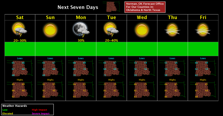
It rained a bit overnight and will continue for a while before moving out this morning. We won’t receive inches of rain but at least a little is better than nothing.
Without all the hype about the cold front coming through Monday evening, I have a question for you. Do you know where your sweaters and jackets are for evening activities? I will say this after frontal passage, highs in the mid to upper 70’s to low 80’s and lows mid to upper 50’s.
Here is your forecast from the NWS/NORMAN;
Saturday-Showers likely and possibly a thunderstorm before 7am, then a slight chance of showers and thunderstorms between 7am and 10am. Cloudy, then gradually becoming mostly sunny, with a high near 87. South wind 6 to 8 mph. Chance of precipitation is 60%. New precipitation amounts of less than a tenth of an inch, except higher amounts possible in thunderstorms.
Saturday Night-Mostly clear, with a low around 67. Southeast wind 5 to 7 mph.
HAVE A SUPER DAY!!
MIKE