0335L-SATURDAY OUTLOOK FROM GARFIELD COUNTY EMERGENCY MANAGEMENT-9/23/23
* The WSR-88D weather radar at Kegelman Field known as KVNX is still down. Replacement parts were ordered but haven’t arrived. Return to service is still undetermined. Will advise when and if it returns to service this weekend.
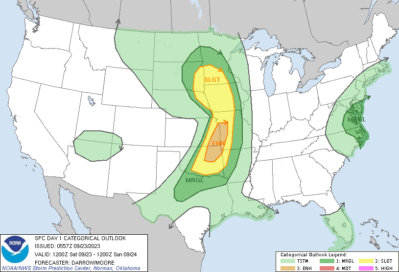
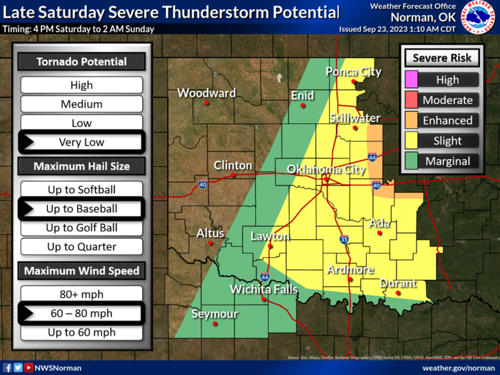
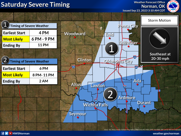
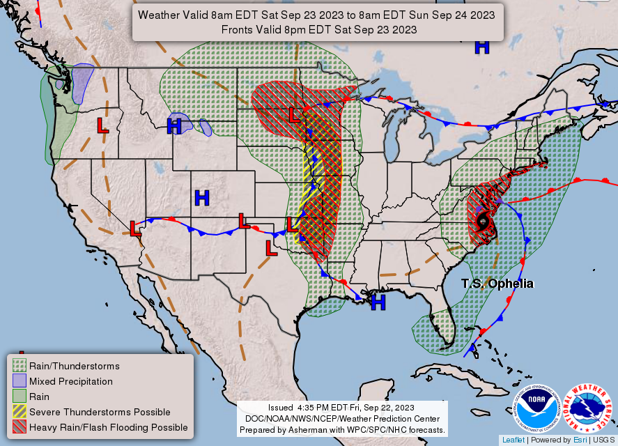
*Dangerous weather is possible this afternoon into the evening hours as a cold front pushes into the state. As of right now, it appears, per guidance, that storms will form just to our east, ahead of the front depending on timing. Either way, if you plan on being east of I-35 today and tonight, stay EXTREMELY WEATHER AWARE.
*When storms form, large hail, damaging winds, and possibly isolated tornadic activity are possible with supercell structures. Again, it appears this will occur just to our east but timing is the key factor. We’ll see what happens.
*Overall, we should be ok so here is your forecast from the NWS/NORMAN;
Today- Mostly sunny. A chance of showers and thunderstorms this afternoon. Highs in the lower 90s. South winds around 15 mph, becoming southwest this afternoon. Chance of rain 30 percent.
Tonight- Mostly cloudy with a chance of showers and thunderstorms in the evening, then partly cloudy with a slight chance of showers and thunderstorms after midnight. Lows in the mid-60s. North winds around 10 mph, becoming northeast after midnight. Chance of rain 50 percent.
We’ll keep an eye on things and advise as needed.
HAVE A GOOD DAY!