FROM GARFIELD COUNTY EMERGENCY MANAGEMENT
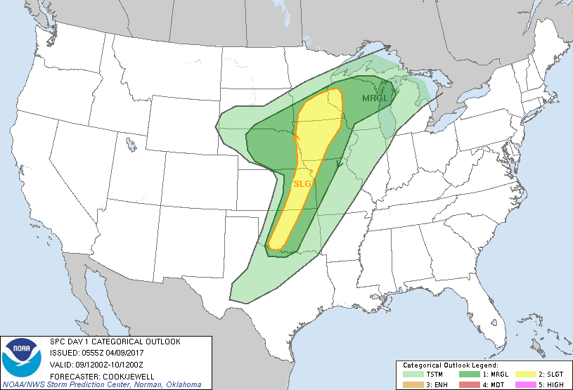
Today is still a very complicated forecast depending on “ifs”. With a trough, front, moisture return, upper level jet, and shear, all factors here, the “capping inversion “will be the main thing to overcome.
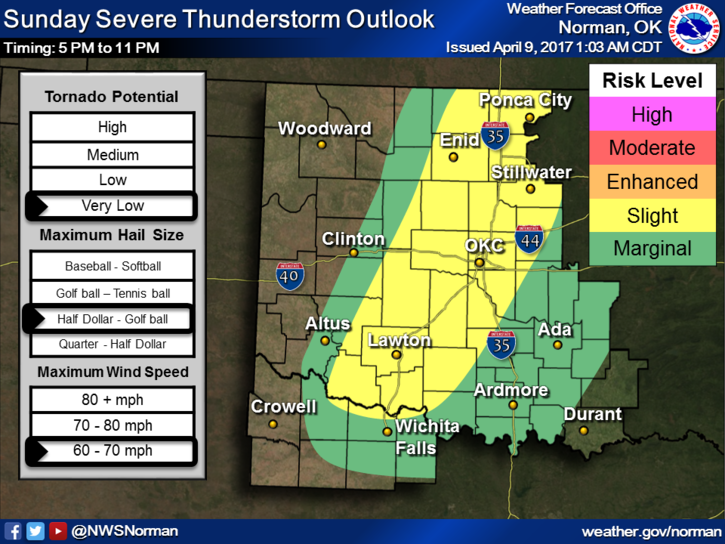
This said, it looks like we may have an evening event if storms occur at all. Storms could occur from 5 pm until 11pm or so. Again the cap will be a big factor. IF STORMS OCCUR, golf ball size hail and winds around 65 mph will be the main threats. As the day progresses, if parameters change I will put out information mainly over our GARFIELD COUNTY EM APP. DOWNLOAD it soon so you stay up with the latest from your Warning Team.
ON Facebook, if we have to go into OPERATION’S MODE later today, we will only post information on the ENID/GARFIELD COUNTY Facebook page, not my personal page. The link to get there from anywhere on Facebook is @EGCEM, yes, all caps. Like us and follow us.
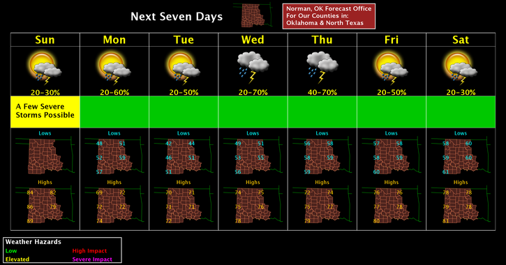
Here is your forecast from the NWS/NORMAN;
Today-20 percent chance of showers and thunderstorms after 3pm. Some of the storms could be severe. Partly sunny, with a high near 82. South southwest wind 15 to 20 mph, with gusts as high as 28 mph.
Tonight-30 percent chance of showers and thunderstorms, mainly between 7pm and 1am. Some of the storms could be severe. Partly cloudy, with a low around 50. South southwest wind around 11 mph becoming north northwest after midnight.
WE’LL ADVISE AS NEEDED SO HAVE A GREAT DAY!!
MIKE