0415L-SUNDAY UPDATE FROM GARFIELD COUNTY EMERGENCY MANAGEMENT-02/11/18
1-COLD AND VERY LIGHT SNOW WILL CONTINUE THIS MORNING.
2- Skies will be slowly clearing around mid-day as the storm system moves out. Just expect continued snow flurries along with cold northerly winds.
3-A warmup into the 60’s is possible by mid-week so those that hate the cold will get a slight reprieve except for the overnight temps.
4-We are under SEVERE drought conditions and the BURN BAN is still in effect so no outdoor burning.
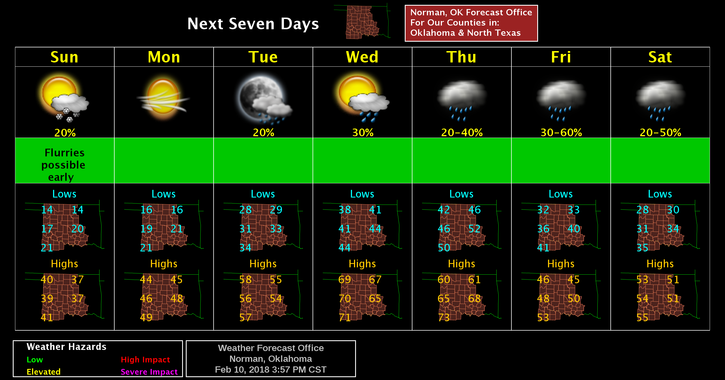
5- Here is your forecast from the NWS/NORMAN;
Sunday-Slight chance of flurries before noon. Mostly cloudy then gradually becoming sunny, with a high near 37. North northwest wind 5 to 15 mph becoming east northeast gusting to 20 mph.
Sunday Night-Clear, with a low around 14. South southeast wind 3 to 6 mph.
STAY WARM AND SAFE,
MIKE