0400L-SUNDAY OUTLOOK & INFO FROM GARFIELD COUNTY EMERGENCY MGMT. 11/10/19
1- GARFIELD COUNTY EM. This is our notification app. If you don’t have it, you’re not prepared.
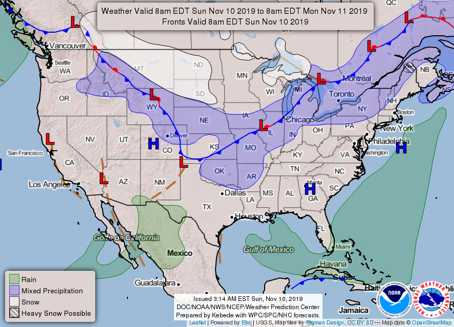
2- The cold front is coming and should be in the area by late this afternoon and early evening. Temps will fall slowly and winds will gradually increase and become strong with gusts upwards of 25 mph. Winds will persist through late Monday afternoon. There is a chance for rain late tonight then a slight chance for some freezing precip. We’ll see what happens!
3- Wind chills will be into the single digits Tuesday morning so be careful and wear a coat. The Fire Danger is increasing so please call 911 if you see smoke or fire out there.
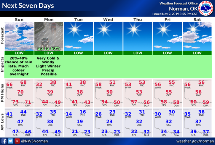
4- FOR TODAY, ENJOY IT!! Here is your forecast from the NWS/NORMAN;
Sunday- Partly sunny with a high near 68. Southwest winds 5 to 10 mph becoming east in the afternoon.
Sunday Night-Mostly cloudy, with a low around 34. North northeast wind 5 to 10 mph increasing to 15 to 20 mph after midnight. Winds could gust as high as 25 mph. Chance of precipitation is 40%.
HAVE A SUPER DAY!!
MIKE