0400L-SUNDAY OUTLOOK FROM ENID/GARFIELD COUNTY EMERGENCY MANAGEMENT-10/14/18
Good morning. First of all, no need for panic as we have had cold weather before. A few things to do around the house should already be done like disconnecting hoses outside and making sure your heating system is working ok. Drafty windows should be sealed up too. For this particular cold spell, hopefully everyone should be ok.
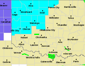
Per guidance, due to the cold front, around 10 am this morning our temps will be in the mid 50’s. By 4 pm in the mid 40’s and by 8pm in the mid 30’s. TIMING MAY VARY. Our overnight low here will be around 34 or so. We have been placed in the FREEZE WATCH starting late tonight through Monday morning by the NWS. A FREEZE WATCH MEANS SUB-FREEZING TEMPERATURES ARE POSSIBLE. THESE CONDITIONS COULD KILL CROPS AND OTHER SENSITIVE VEGETATION. See graph below.
WIND CHILL will become a big factor with 20-25 mph winds. Be sure to cover up your skin.
Here is your forecast from the NWS/NORMAN;
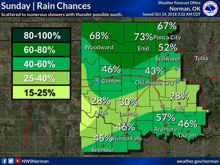
Sunday-Cloudy with rain showers likely. Highs in the mid-50s with East winds around 10 mph shifting to the north 10 to 20 mph in the afternoon. Chance of showers is 70 percent.
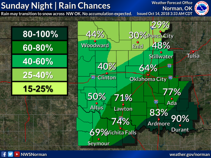
Sunday Night-Mostly cloudy with a chance of showers in the evening and then a slight chance of rain or snow after midnight. Colder with lows in the low to mid-30s. North winds 15 to 20 mph. Chance of precipitation 50 percent.
Have a good day and stay warm!! Download our GARFIELD COUNTY EM app!!
Mike