0430L-THURSDAY OUTLOOK FROM ENID/GARFIELD COUNTY EMERGENCY MANAGEMENT-12/6/18
1- WINTER STORM WATCH STILL IN EFFECT FROM FRIDAY MORNING THROUGH SATURDAY EVENING. This might change some today so don’t be too surprised. This would be based on timing.
2- IF you plan on traveling, DO IT TODAY! Traveling later on Friday and Saturday may be difficult in some areas. ROAD CONDITIONS can be found on the front page at https://gcem.org
3- Download our GARFIELD COUNTY EM app. Any NWS WARNING automatically comes through our app. A COLD FRONT WILL PUSH THROUGH THE AREA TODAY.
4- I won’t go into super detail concerning the forecast simply because there are still many variables on timing, amounts of both snow and ice, and where this will occur for sure. That is just almost impossible to predict in winter weather. There is a lot of drama out there so here are my main words for this event; A– it will snow and we may see some icing. B-it will be worse in some areas than others. C– road conditions will be extremely treacherous. D-we can’t stop what’s going to happen, where it’s going to happen, when it’s going to happen, so just stay inside and enjoy whatever falls from the sky and stay warm while doing so. Let the kids go out and have fun, just tell them to be careful.
5- Here is your forecast for today from the NWS/NORMAN;
Today-Mostly cloudy then gradually becoming sunny with a high near 38. North northeast wind 5 to 15 mph increasing to 15 to 20 mph in the morning. Winds could gust as high as 25 mph.
Tonight- Partly cloudy with a low around 22. North northeast winds 5 to 10 mph.
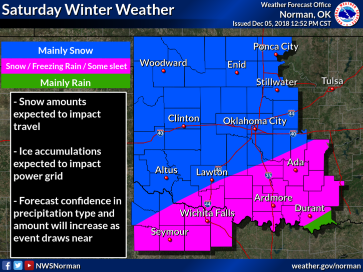
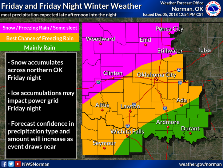
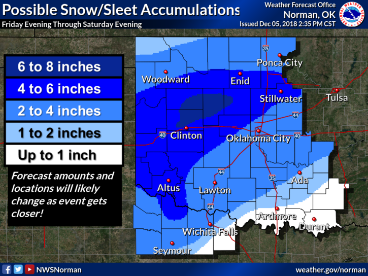
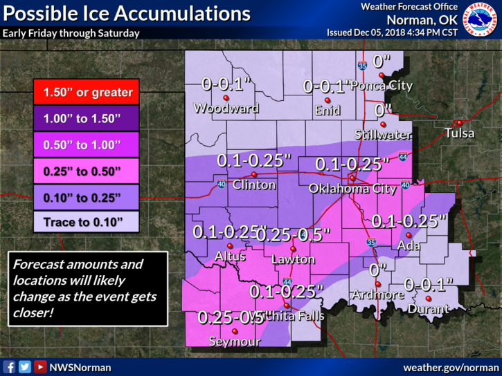
HAVE A SUPER DAY AND SEE GRAPHICS BELOW. These are from late yesterday. They will be updated on our gcem.org front page during the day. A GARFIELD COUNTY EM app advisory will occur this afternoon.
MIKE