0345L-THURSDAY OUTLOOK FROM GARFIELD COUNTY EMERGENCY MANAGEMENT-5/9/19
NO STORMS last night and that was good. There is a chance for showers and possibly a few thundershowers this morning but nothing severe is expected. This is due to a trough moving across the area today.
- It will be definitely be cooler for the next few days so enjoy the cooler temps while you can. Summer is just around the corner and the HEAT will be on.
- I would suggest that many of you take some time to re-evaluate your preparedness strategy when it comes to storms. It amazes me how many folks end up in the “PANIC ZONE” long before storms ever arrive. Don’t allow outside influence’s to affect your emotions as decision making under pressure is difficult for many and you really need to be able to make decisions with good information and with that understanding that you know what to do. Some of you may see where I’m going with this. The main thing here to remember is that storms will always occur. Understand the basic dynamics of what’s going on. “KNOW” what you are going to do in certain situations so panic is lessened a bit. This is what preparedness is all about.
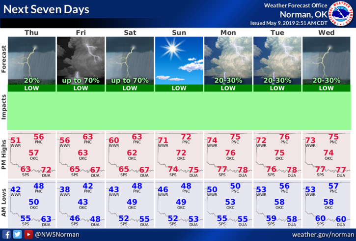
- Here is your forecast from the NWS/NORMAN;
- Thursday-30% chance of showers and thunderstorms, mainly after 7am. Mostly cloudy, with a high near 53. North northwest wind 15 to 20 mph, with gusts as high as 28 mph.
- Thursday Night-Mostly cloudy, with a low around 41. North wind 6 to 13 mph
Have a good day!
Mike