0335L-TUESDAY OUTLOOK FROM GARFIELD COUNTY EMERGENCY MANAGEMENT-4/12/22
1-Here is your forecast from the NWS/NORMAN;
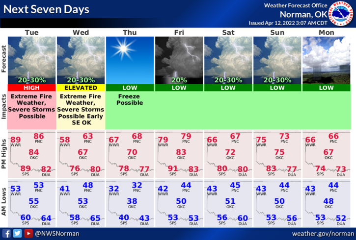
Today-Sunny and windy. Highs in the upper 80s. South winds 20-30 mph gusting up to 50 mph.
Tonight-Mostly clear in the evening, then partly cloudy with a slight chance of showers and thunderstorms after midnight. Some thunderstorms may be severe. Windy with lows in the upper 40s. South winds 25 to 30 mph, becoming northwest 15 to 25 mph after midnight. Gusts up to 45 mph. Chance of rain 20 percent.
2- WIND ADVISORY IN EFFECT from noon today until 7pm this evening. Wind gusts to 50 mph are possible.
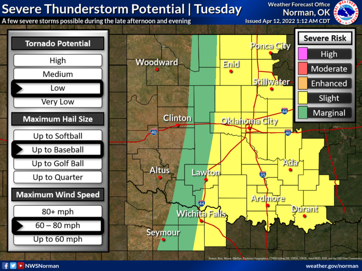
3-SLIGHT RISK FOR SEVERE WEATHER later today and tonight- “ALL HAZARDS” are possible. Spotters will be utilized if storms develop discreetly. I have a briefing with the NWS at 10 am. Additional information will be sent after that briefing over the GARFIELD COUNTY EM app and on social media.
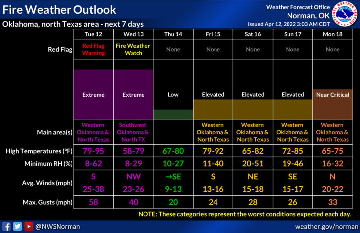
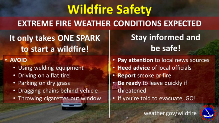
4- FIRE DANGER IS CRITICAL TODAY HERE IN THE COUNTY. We aren’t included in the RED FLAG warning but we could be later depending on the dryline this afternoon. Either way, it will be very windy and dirty outdoors. Report ANY FIRE OR SMOKE that you see to 911, so the proper response can be sent. Fire personnel need to make sure your chiefs know your availability.
5- Overall, we’ll be ok so HAVE A GOOD DAY!