0340L-TUESDAY OUTLOOK FROM ENID/GARFIELD COUNTY EMERGENCY MANAGEMENT-12/11/18
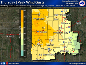
1- WINDY is the word for the next several days as the gradient tightens. Models are not in agreement on where this next system will actually track and what type of precipitation will occur. Strong winds are the main issue right now.
2- FIRE DANGER is always a risk when winds are strong. Even though the ground isn’t totally dry, the foliage is, thus a risk for fire. Be extremely careful utilizing anything fire related and use good judgement on starting a controlled burn. Remember that controlled burning requires attendance to the fire. If you leave, it’s out of control and it will be put out.
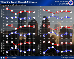
3- Here is your forecast from the NWS/NORMAN;
Tuesday-Increasing clouds, with a high near 59. South southwest wind 10 to 15 mph increasing to 15 to 20 mph in the afternoon. Winds could gust as high as 30 mph.
Tuesday Night-Mostly cloudy, with a low around 32. South southwest wind 5 to 15 mph gusting to 20 mph becoming northwest after midnight.
HAVE A GREAT DAY!!
MIKE


