0345L-TUESDAY OUTLOOK FROM GARFIELD COUNTY EMERGENCY MANAGEMENT-6/25/19
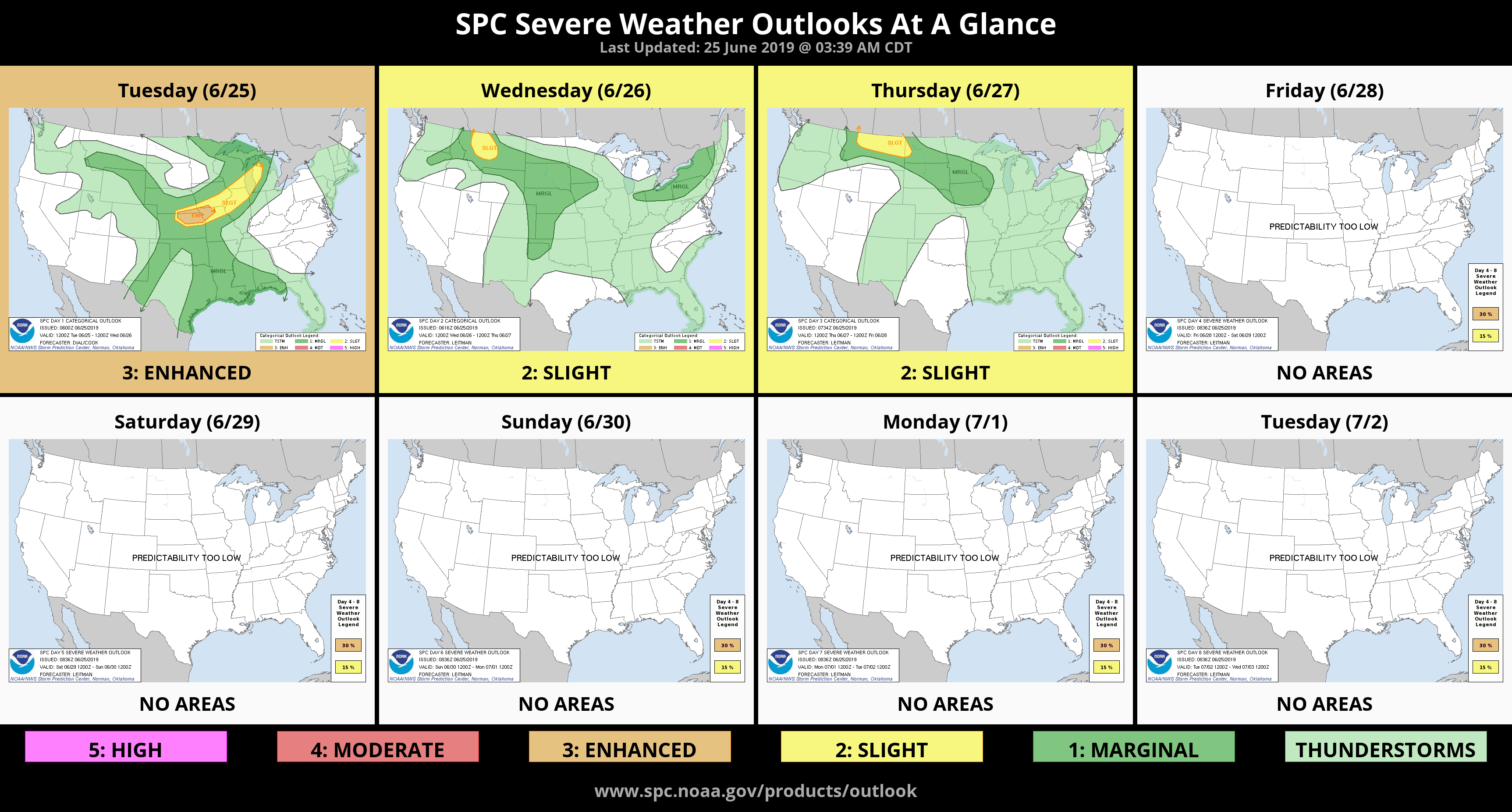
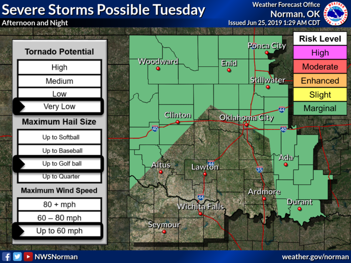
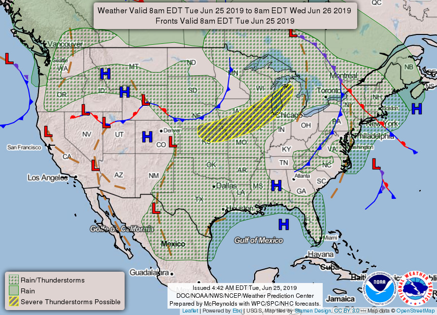
1- MARGINAL RISK FOR SEVERE THUNDERSTORMS LATER TODAY. “IF” STORMS OCCUR, LARGE HAIL AND DAMAGING WINDS WILL BE THE MAIN THREATS.
2- Other than the above, we will gradually be warming up this week and we’ll also be humid so pace yourselves while doing any outdoor activities. Make sure outdoor animals have plenty of food and water too.
3- Download our GARFIELD COUNTY EM app. Your better prepared with it than without it!
4- I will be meeting with FEMA officials today to discuss disaster information. After these discussions, pay close attention to media articles as those will outline what you will need to do to possibly receive help and what they will be doing here in the area. REMEMBER, FEMA officials carry IDENTIFICATION. Anyone showing up at your door from FEMA will have one. Ask to see it. There is some fraudulent activity going on around the state so be EXTREMELY CAREFUL.
5- Here is your forecast from the NWS/NORMAN;
Tuesday-Partly cloudy. A slight chance of thunderstorms in the afternoon. Highs in the lower 90s. South winds 10 to 15 mph. Chance of thunderstorms 20 percent.
Tuesday Night-Partly cloudy with a slight chance of thunderstorms. Lows in the upper 60s. South winds 10 to 15 mph. Chance of thunderstorms 20 percent.
HAVE A GOOD DAY!!
MIKE