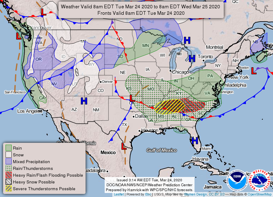
0350L-TUESDAY OUTLOOK FROM GARFIELD COUNTY EMERGENCY MGMT-3/24/2020
1-SEVERE THUNDERSTORM WATCH IN EFFECT UNTIL 8am THIS MORNING. It most likely will be cancelled before 8 if storms move out of the area.
2- Be sure and download our GARFIELD COUNTY EM app. You can receive alerts from the NWS, Garfield County Sheriff, Enid Police, and now from the Garfield County Health Department, along with us at GCEM, of course. Stay prepared and informed.
3- Weather-wise, as this system moves out this morning a front will push in giving us north winds 5-10 mph. We’ll be ok.
4- As stated in a post last night, the Vance WSR-88D weather radar will be down from today through March 31 for an upgrade. Again, we’ll be ok.
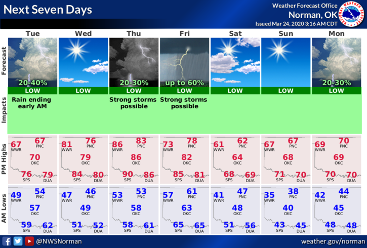
5- Here is your forecast from the NWS/NORMAN;
Today-Decreasing clouds. Highs in the upper 60s. North winds around 10 mph.
Tonight-Mostly clear. Lows in the mid-40s. Light and variable winds becoming southeast around 10 mph after midnight.
HAVE A GOOD DAY!!
MIKE