0410L-TUESDAY OUTLOOK & INFO FROM GARFIELD COUNTY EMERGENCY MANAGEMENT-10/15/19
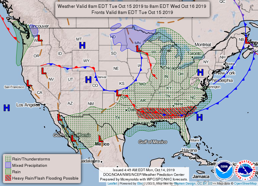
1- Another cold front is on its way and should be in and through the area sometime this morning or early afternoon. We shouldn’t have any rain with this front but we will have the winds for a little while. We are in a GENERAL THUNDERSTORM RISK area so anything could happen. Overall, we’ll be ok.
2- On our GARFIELD COUNTY EM app, it has been updated with a few changes I requested. Enid PD and the Sheriff’s office can now put out information over the app. Instead of calling me to do that, they can do it themselves. This will save time in the event something major occurs. These channels can be turned off and on WITHOUT a password to access it. On the app, go to Settings near the top right of the screen. TAP IT and Notification settings come up. Tap it and all channels will be shown. Make sure you have both channels on and you’ll receive info from either agency when they deem it necessary to send out information. This is another step for you all to have towards the preparedness process.
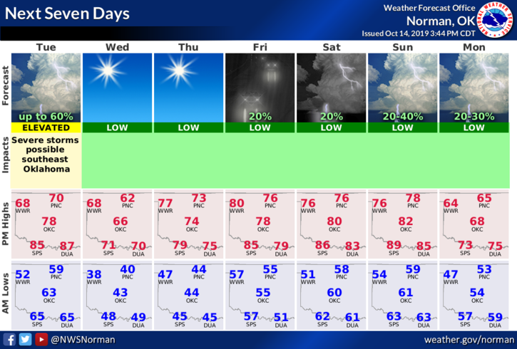
3-Here is your forecast from the NWS/NORMAN;
Today-Slight chance of showers between 7am and 10am. Areas of fog between 7am and 10am. Otherwise, partly sunny with a high near 69. South southwest wind 5 to 15 mph becoming north 15 to 25 mph in the morning. Winds could gust as high as 30 mph. Chance of precipitation is 20%.
Tonight-Clear, with a low around 41. North wind 6 to 11 mph.
HAVE A SUPER DAY!!
MIKE