0415L-TUESDAY UPDATE FROM ENID/GARFIELD COUNTY EMERGENCY MANAGEMENT-9/18/18
1: Enjoy the next few days. A cold front will pass through the area bringing some rain and cooler temps. There are still several questions about how much rainfall and where it will fall. These answers will become a bit clearer as the front gets closer and moves in. Timing and the deeper moisture will play a part in rainfall totals. Don’t get hung up on totals right now. It’s still a ways out.
2: Overall, we’ll be ok. As with any rain event, be cautious of low lying areas and don’t let the kids play in swift water in the creeks. Watch out for snakes and other critters.
3: Your first level of preparedness here in Garfield County is our GARFIELD COUNTY EM app. It’s loaded with information and emergency numbers along with direct notifications from GCEM and the NWS.
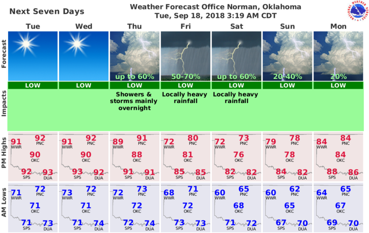
4: Here is your forecast from the NWS/NORMAN;
Tuesday: Sunny with a high near 93. South southwest winds 5 to 15 mph with gusts as high as 21 mph.
Tuesday Night-Mostly clear with a low around 73. South winds 5 to 15 mph.
FINALLY- Mark your calendars for our 2nd Annual Disaster Resilience Seminar. See details on our website about mid front page at gcem.org
HAVE A SUPER DAY!!
MIKE