0400L-WEDNESDAY OUTLOOK FROM GARFIELD COUNTY EMERGENCY MANAGEMENT-4/17/19
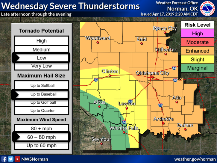
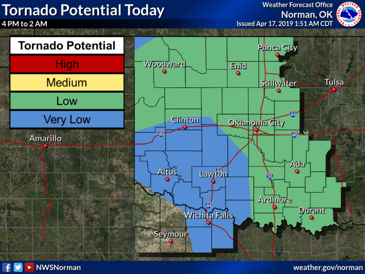
1- We are in an ENHANCED RISK for severe weather later today. Here is an excerpt from the NWS discussion: NORTHERN OKLAHOMA: CONFIDENCE IS HIGH THAT CONVECTION WILL DEVELOP ALONG THE COLD FRONT ACROSS NORTHERN OKLAHOMA MID TO LATE AFTERNOON. NUMEROUS THUNDERSTORMS ARE EXPECTED WITH THE POTENTIAL FOR LARGE HAIL AND DAMAGING WIND GUSTS. THERE COULD BE AN INITIAL LOW TORNADO RISK; HOWEVER, STORM INTERACTIONS/MERGERS, UPSCALE GROWTH, AND UNDERCUTTING BY THE COLD FRONT SHOULD LIMIT THE TEMPORAL EXTENT OF THIS RISK. OVER TIME, THE CONVECTION ALONG THE COLD FRONT MAY BECOME MORE POST-FRONTAL/ELEVATED AS THE COLD FRONT ACCELERATES SOUTHWARD. AS A RESULT, CONVECTION MAY WEAKEN AS MOVES TOWARD CENTRAL OKLAHOMA.
2- Our network of STORM SPOTTERS may be deployed later today as storms move in especially if the tornado threat increases which doesn’t look likely right now.
3- We have briefings scheduled for today and I will update after the briefings.
4- Here is your forecast from the NWS/NORMAN;
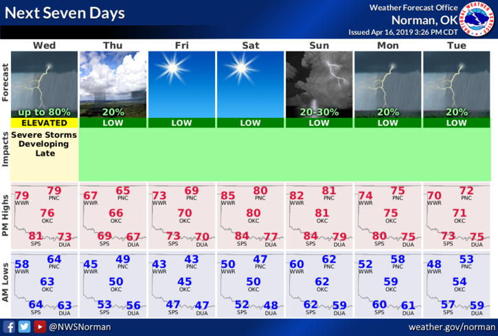
Wednesday-50% chance of showers and severe thunderstorms. Mostly cloudy with a high near 79. South-southwest winds 10 to 20 mph gusting to 25 mph.
Wednesday Night- Showers and thunderstorms likely, mainly before 1am. Some storms could be severe. Mostly cloudy with a low around 48. South wind 7 to 12 mph becoming north 15 to 20 mph after midnight. Winds could gust as high as 28 mph. Chance of precipitation is 70%.
TAKE A DEEP BREATH, LET IT OUT, WE’LL BE OK.
MIKE