0430L-WEDNESDAY OUTLOOK FROM GARFIELD COUNTY EMERGENCY MANAGEMENT-7/6/22
1- HEAT ADVISORY IN EFFECT FROM 1PM UNTIL 8PM TODAY AND THURSDAY.
2- Here is your forecast from the NWS/NORMAN;
Today-Sunny, hot with highs around 104. South winds 10 to 15 mph with gusts up to 25 mph.
Tonight-Mostly clear. Lows around 80. South winds 10 to 15 mph with gusts up to 25 mph. Heat index values up to 106 early in the evening.
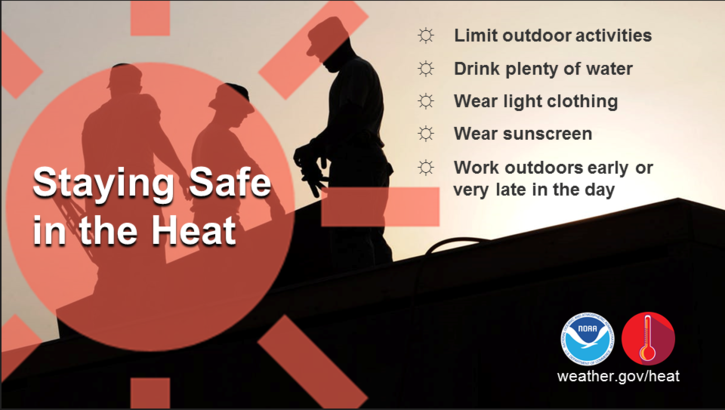
3- Use EXTREME CAUTION WHILE WORKING OUTSIDE.
4- We are in a Severe drought and I want to remind everyone to be careful utilizing anything related to fire. We had a structure fire yesterday where responders from Breckinridge, Garber, Enid, Hillsdale-Carrier, Fairmont, Hunter, Pioneer-Skeleton Creek battled the structure fire but unfortunately it was a total loss. The fire burned approximately 10 acres or so too. In 102 temperatures, Hydration is exceptionally important. Thanks to all that responded and thank you Chief Currier of EFD for bringing out extra ice water and some watermelon for us.
STAY COOL DURING THIS HEAT WAVE AS THE HEAT ISN’T GOING ANYWHERE.