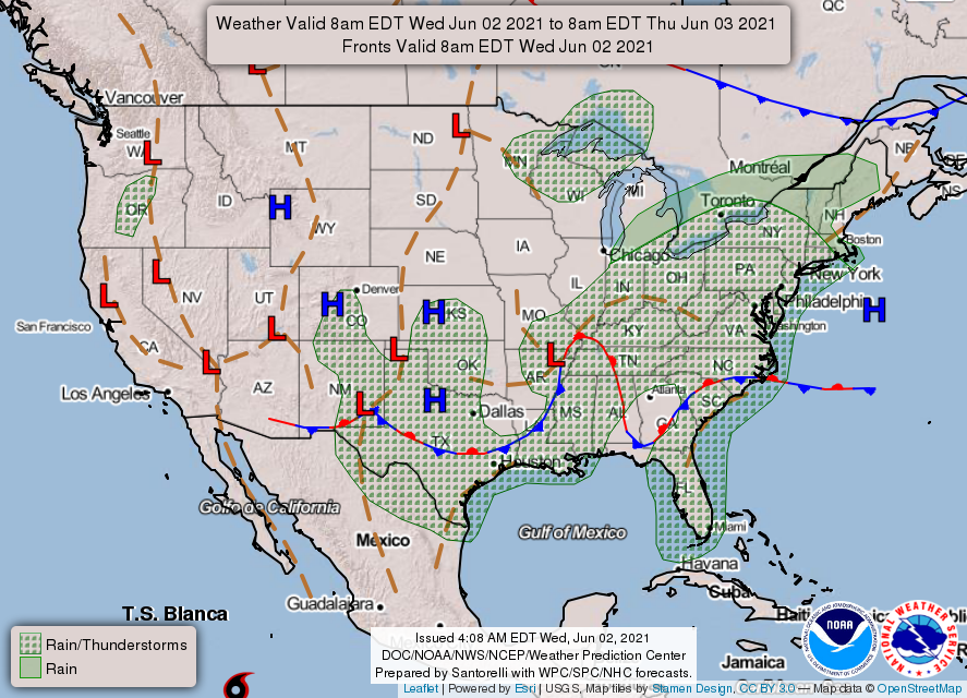
0340L-WEDNESDAY OUTLOOK FROM GARFIELD COUNTY EMERGENCY MANAGEMENT-6/2/21
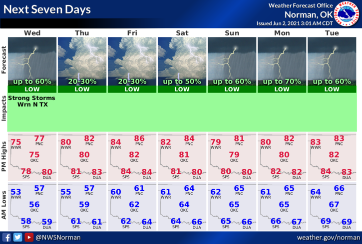
1- GENERAL THUNDERSTORM RISK once again. Per forecast guidance, the higher chances for storms appear to be south, southwest, and then southeast of our area. Even though showers could occur anywhere in the region, our chances are only around 20%.
2- The above said, Thursday through Saturday appear to be NON-RAIN days so hopefully we dry out enough to get the mowing done. Sunday, rain chances go up once again as another storm system pushes in. Just keep in mind that when this cooler air leaves the area, the heat and humidity will return.
3- It probably wouldn’t be a bad idea to get some mosquito dunks and drop a few into the creek areas to limit the mosquito risk. Once we warm up a bit more, they will definitely be on the loose. Also, I have noticed snakes seem to be out and about on the warmer days so keep an eye out especially if you live near a drainage area and you allow the kids to play in or near them. Kids may not realize the snake issue until they get bit. Keep a close eye on them!
4- Overall, we’ll be ok so stay aware and keep an eye on the kids and the weather. Here is your forecast from the NWS/NORMAN;
Today-Patchy fog early in the morning. Mostly cloudy with a slight chance of thunderstorms. Highs in the upper 70s. Light and variable winds. Chance of thunderstorms 20 percent.
Tonight-Partly cloudy. Lows in the mid-50s. Light and variable winds.
Be sure and download our Garfield County EM app. It just might save your life. Have a great day!!
MIKE